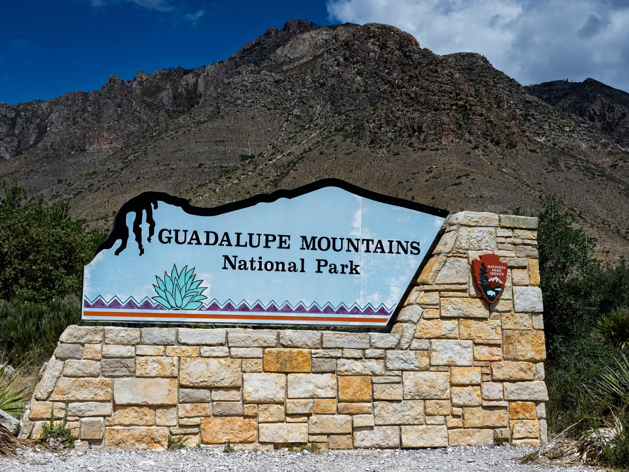
Guadalupe Mountains National Park
The day before hiking Guadalupe Peak, we walked inside and below the reef.
Carlsbad Caverns gave us the underground version. The next morning, I drove toward Guadalupe Mountains National Park to climb the exposed version.
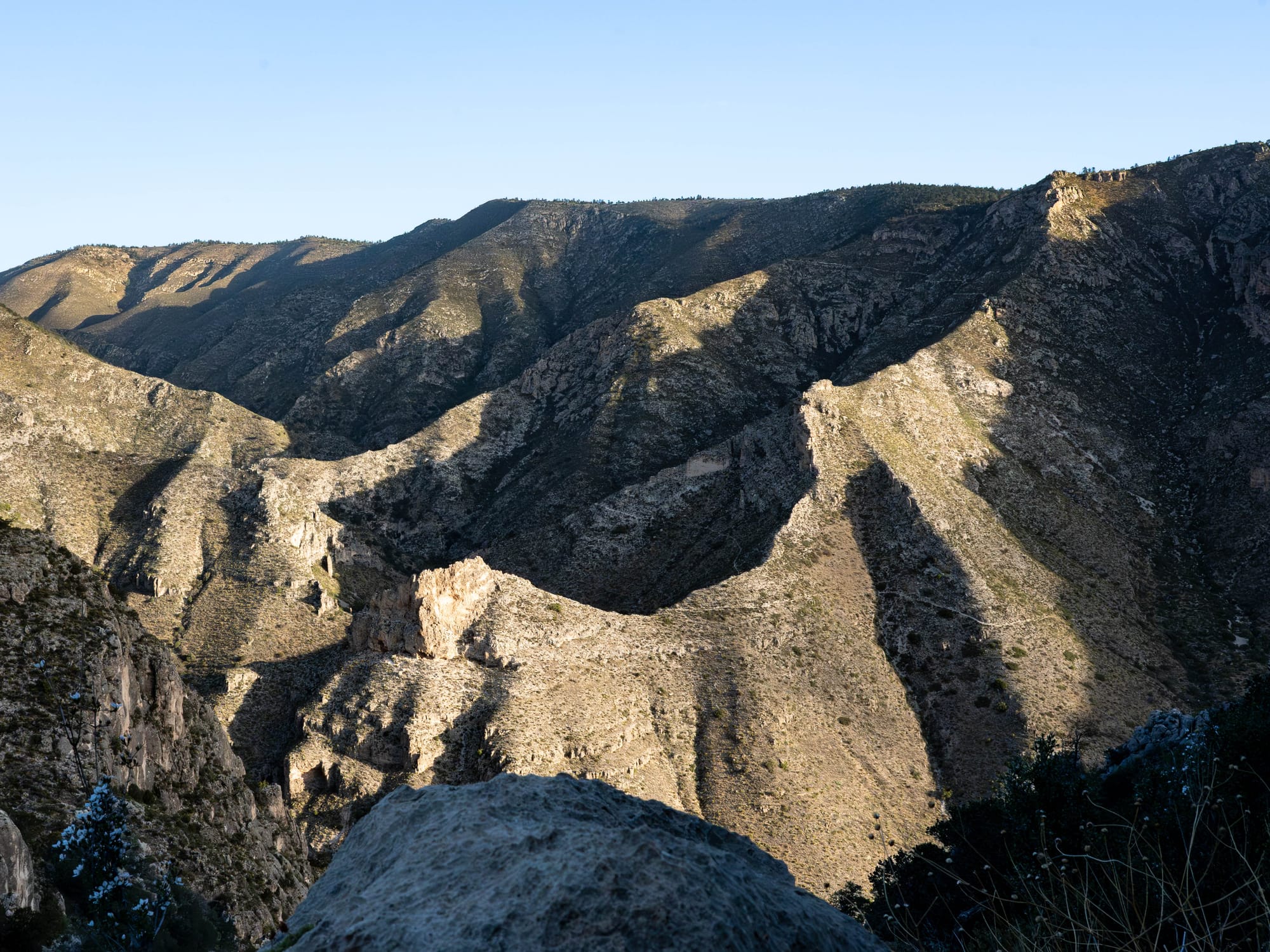
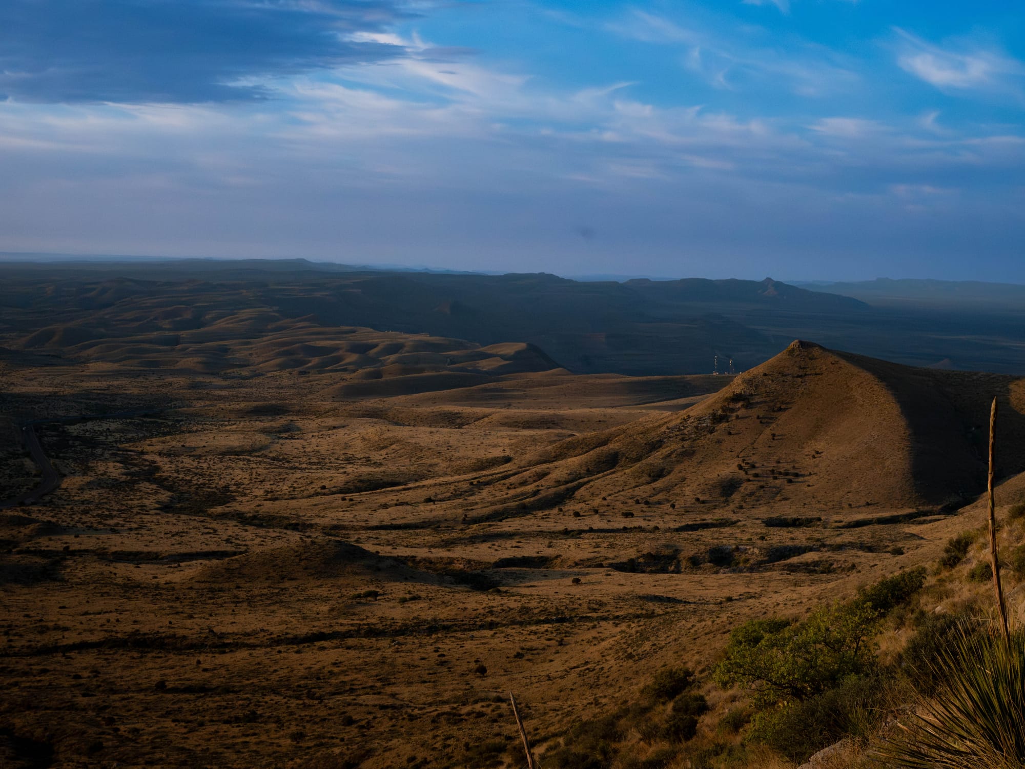
I didn’t fully understand that connection when we first arrived in the area. Coming in from the northeast, the mountains reveal themselves slowly. Past Carlsbad, the land starts to build. The ridges get larger, the formations get bolder, and the desert stops feeling flat.
It is not the same “Bam, there it is” view you get coming north from the salt flats, where El Capitan and Guadalupe Peak rise almost all at once. From our direction, the park arrived gradually.
One day down into the reef.
The next day up onto it.
🗺️ The Lay of the Land
- Location: Salt Flat, Texas · 31.9230, -104.8855 · [Google Maps]
- Official site: [Guadalupe Mountains National Park]
- Landscape: Chihuahuan Desert · fossil reef mountains
- Our visit & conditions: April 2026 · day visit to climb Guadalupe Peak
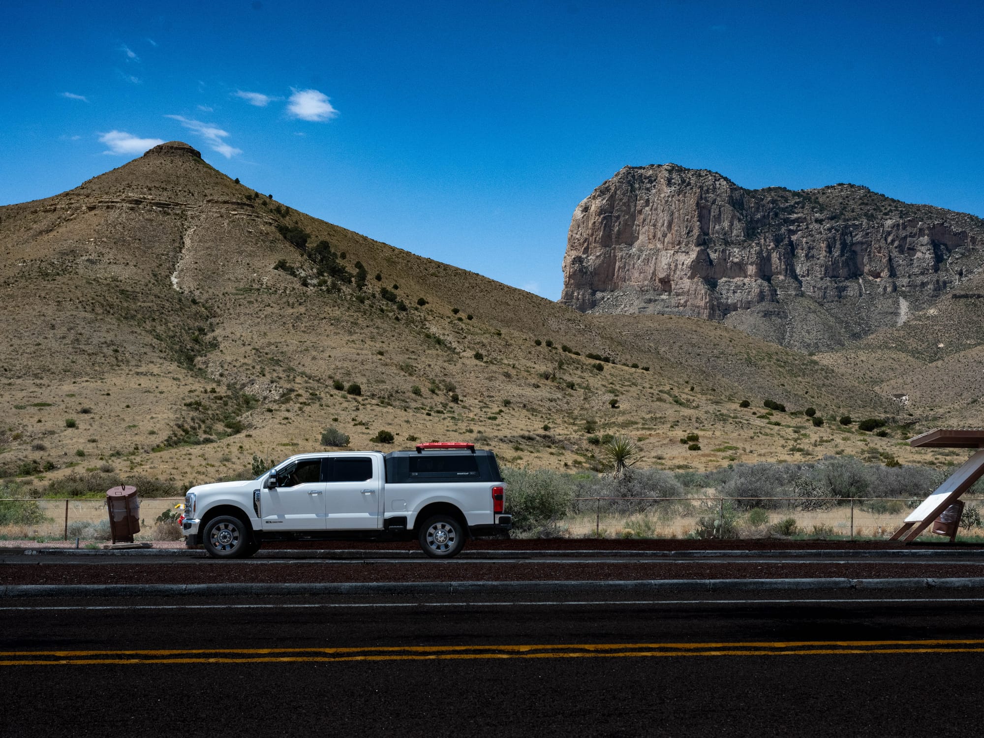
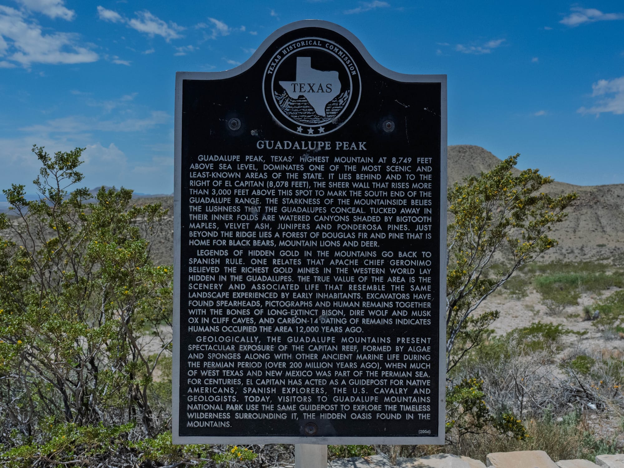
- Height: Tallest Peak in Texas: 8,749'
The Climb
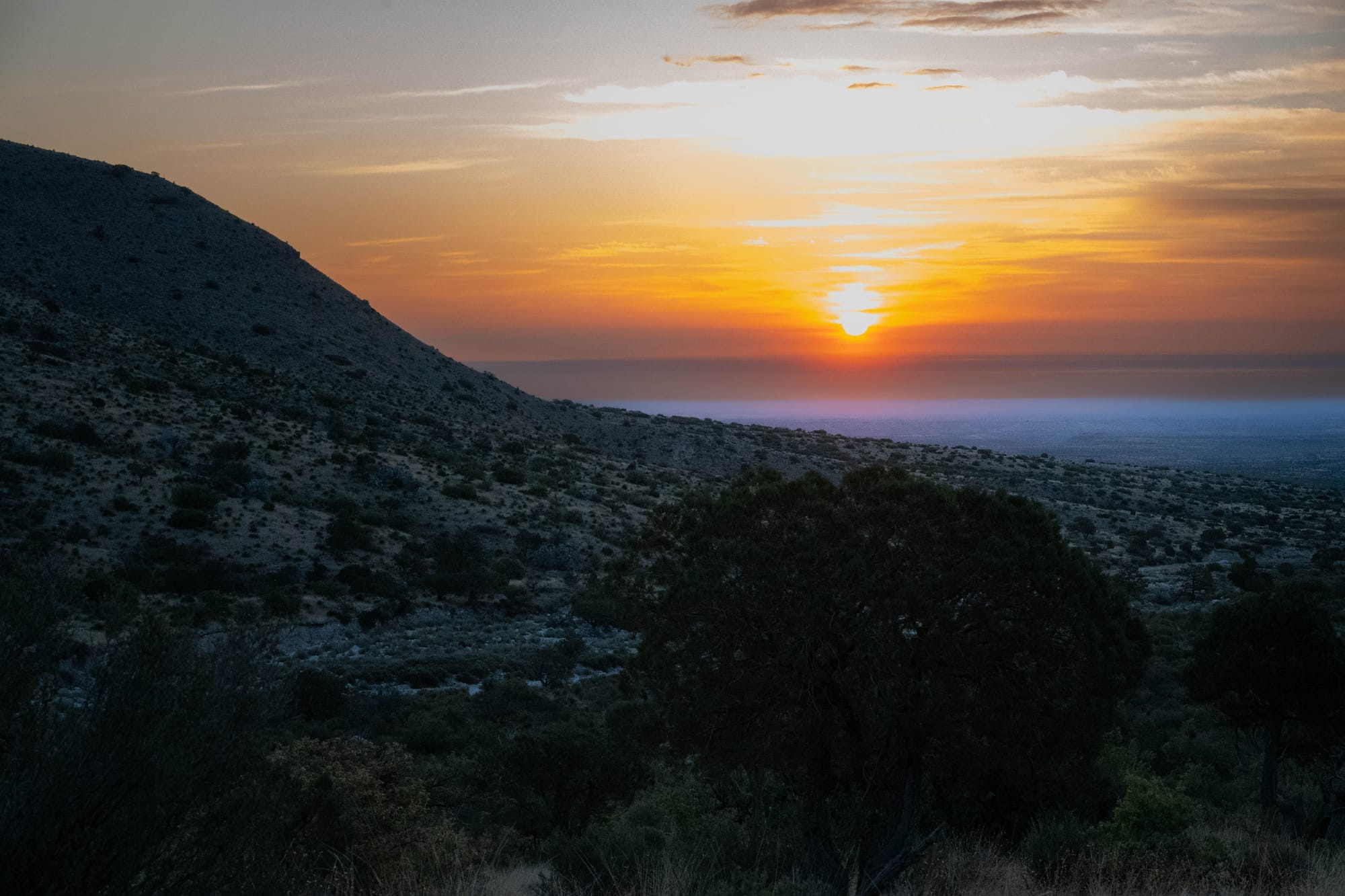
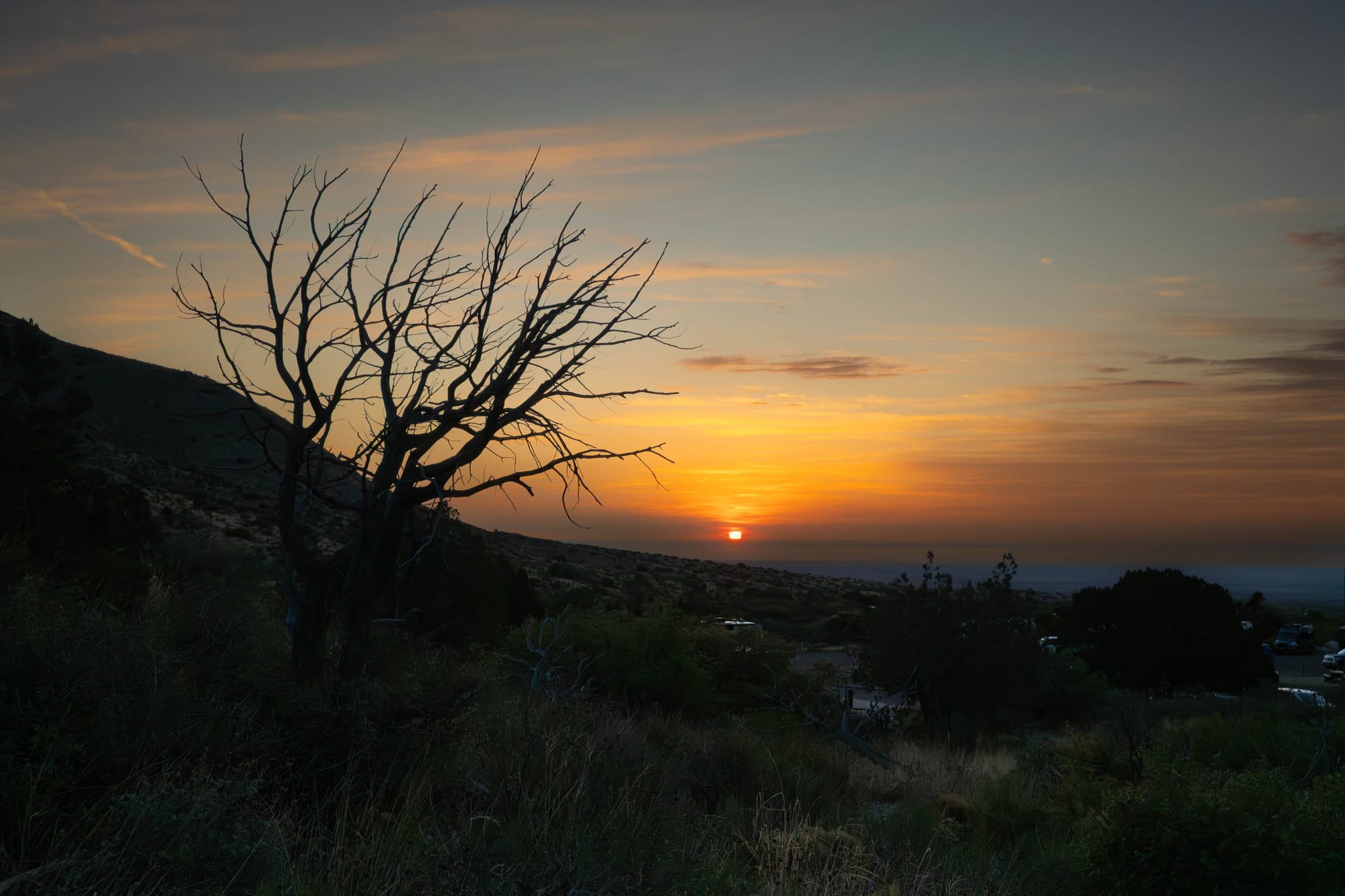
I left Brantley Lake around 4:30 a.m. and reached the trailhead just after sunrise.
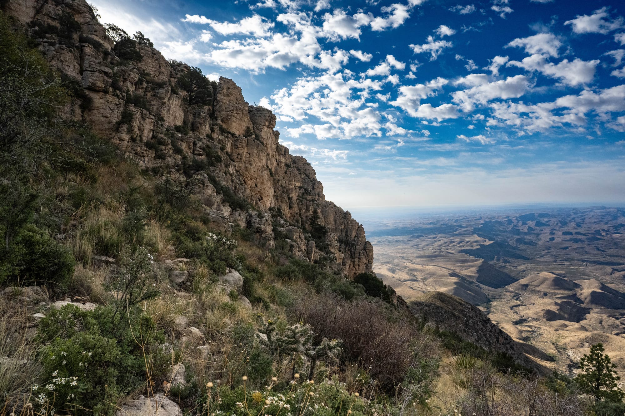
The timing worked. First light was already moving across the peaks and ridgelines, throwing shadows into the folds of the mountain. For the first part of the hike, the landscape changed every few minutes.
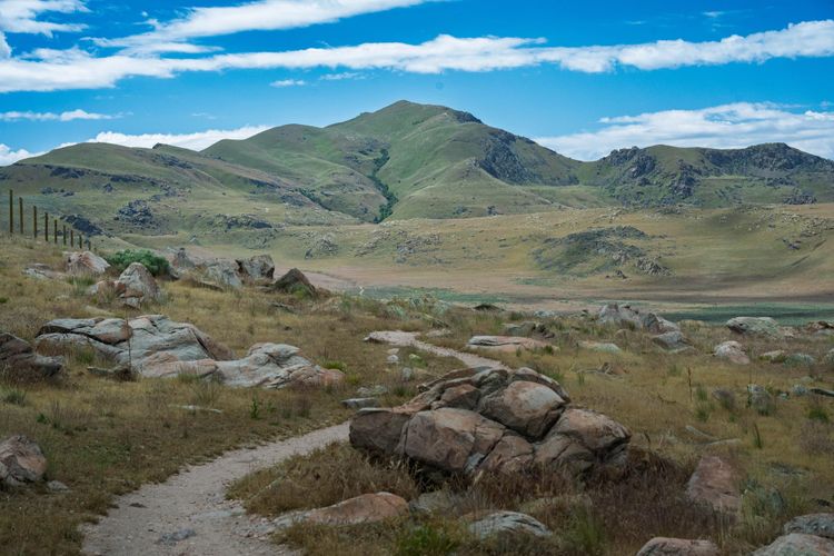
The trail does not waste time.
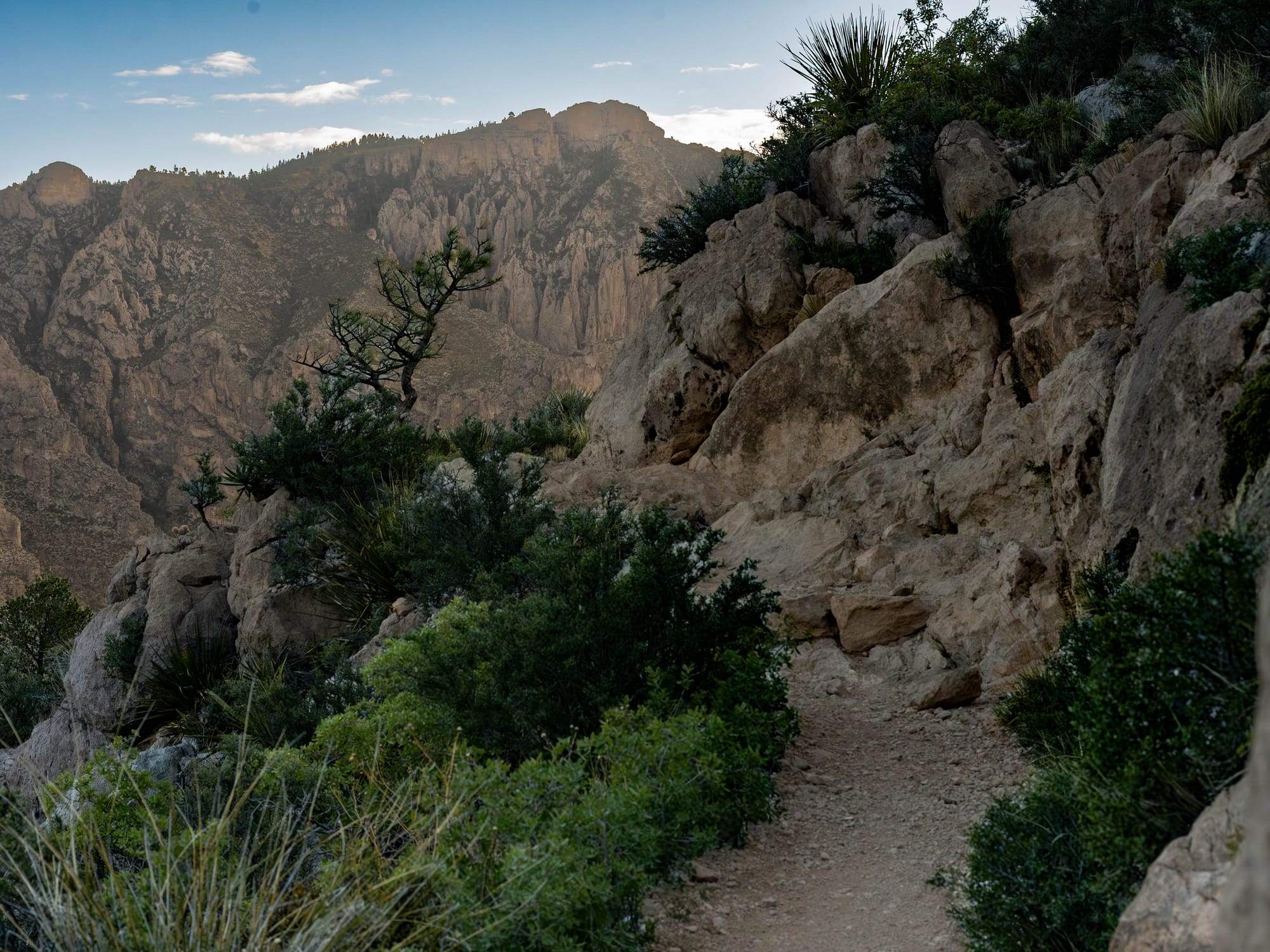
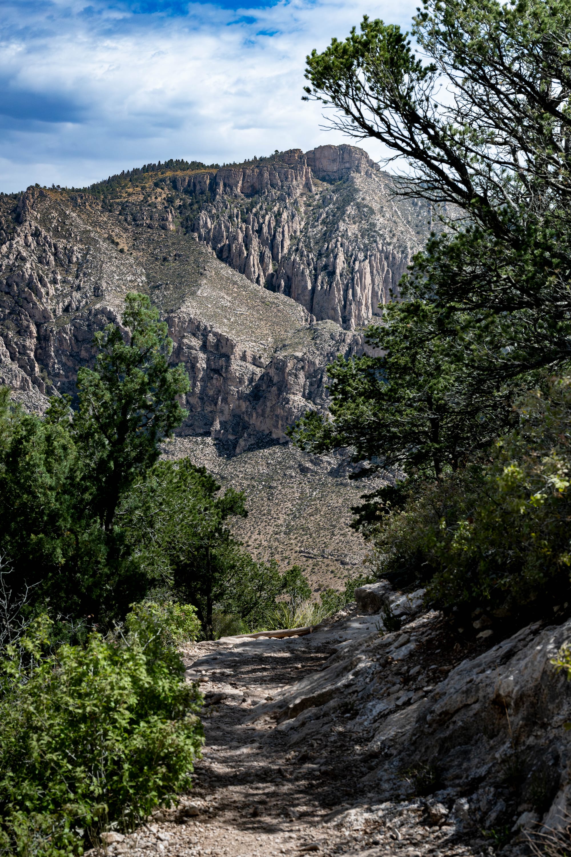
The first mile and change climbs hard, gaining nearly 1,200 feet quickly. It is clear and well-built, but you feel the grade right away. After that, the climb settles into a steadier rhythm. Miles 1.5 to 3 are still uphill, but more consistent. Enough effort to keep your attention, not enough to break the flow.
Near the ridgeline, the trail changed again.
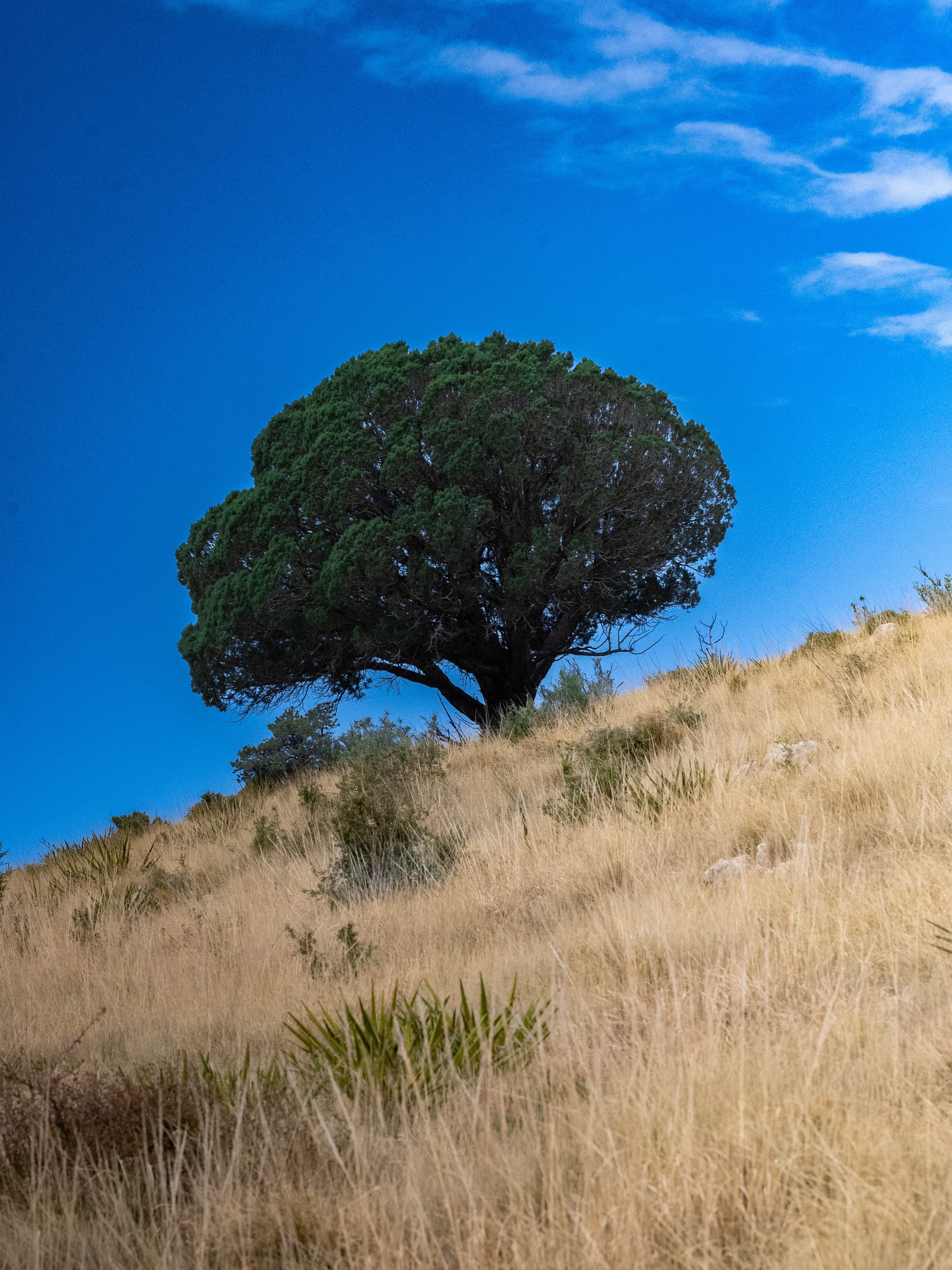
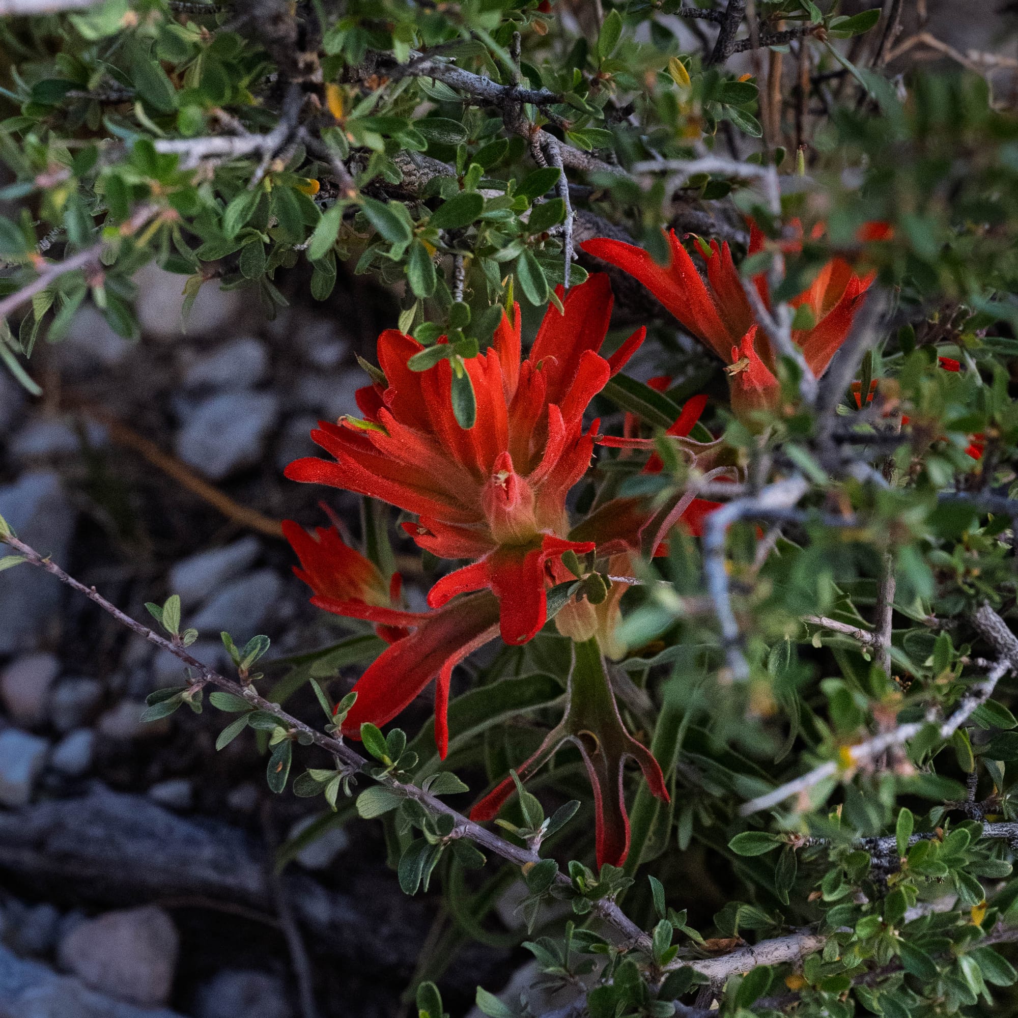
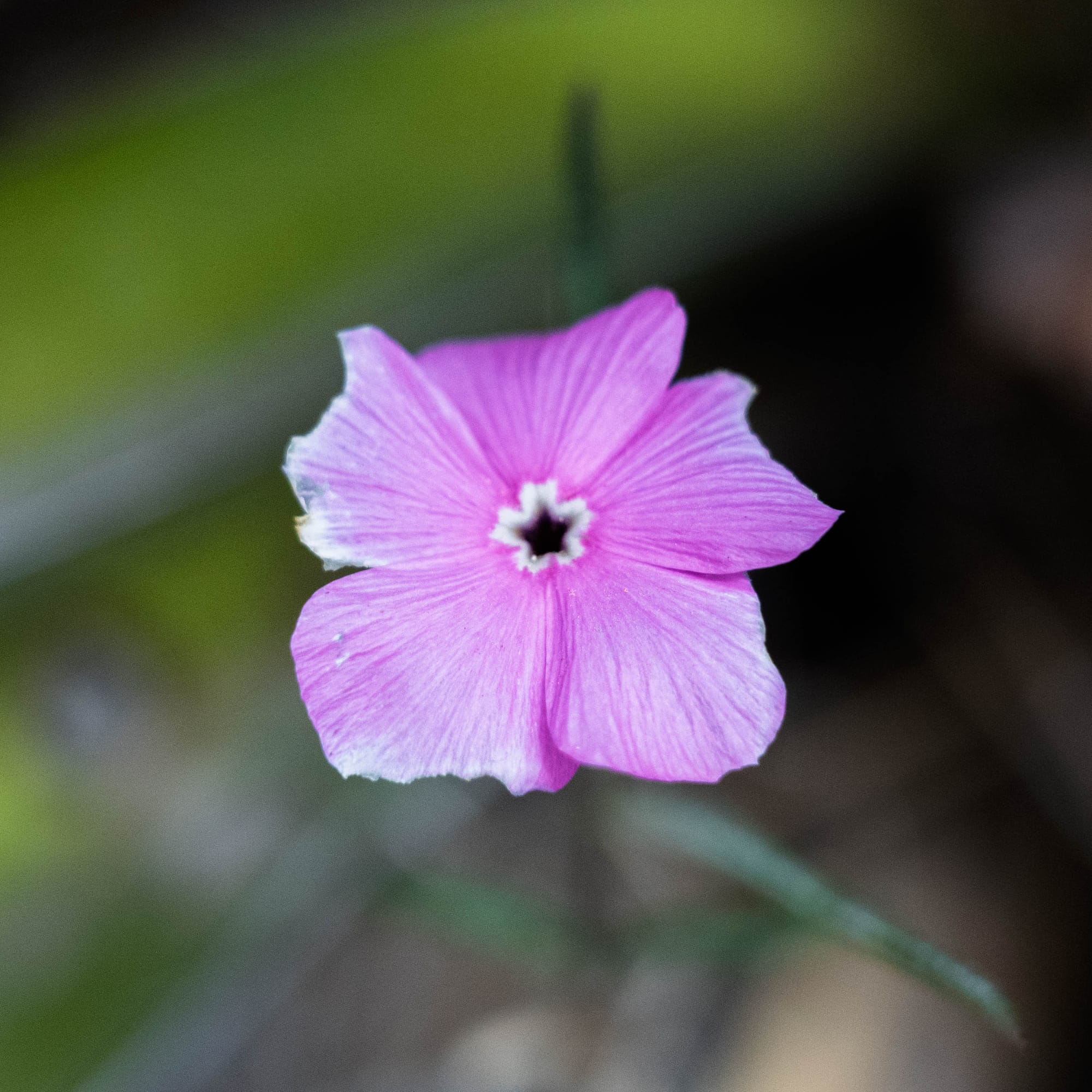
Just as the sun was getting higher on the exposed side, the route tucked into a more sheltered section. More trees, more shade, more plant life. It felt like stepping into a different version of the same mountain.
There was another climb near the summit, but nothing unreasonable. No major wind, no weather problems, and comfortable conditions the whole way.
I passed only a few people on the way up, saw a small group at the summit, and passed a handful more coming down. Quiet enough to feel like I had the mountain to myself.

On the Ground
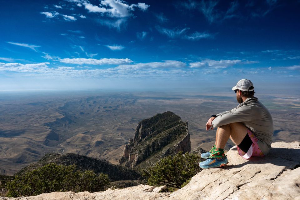
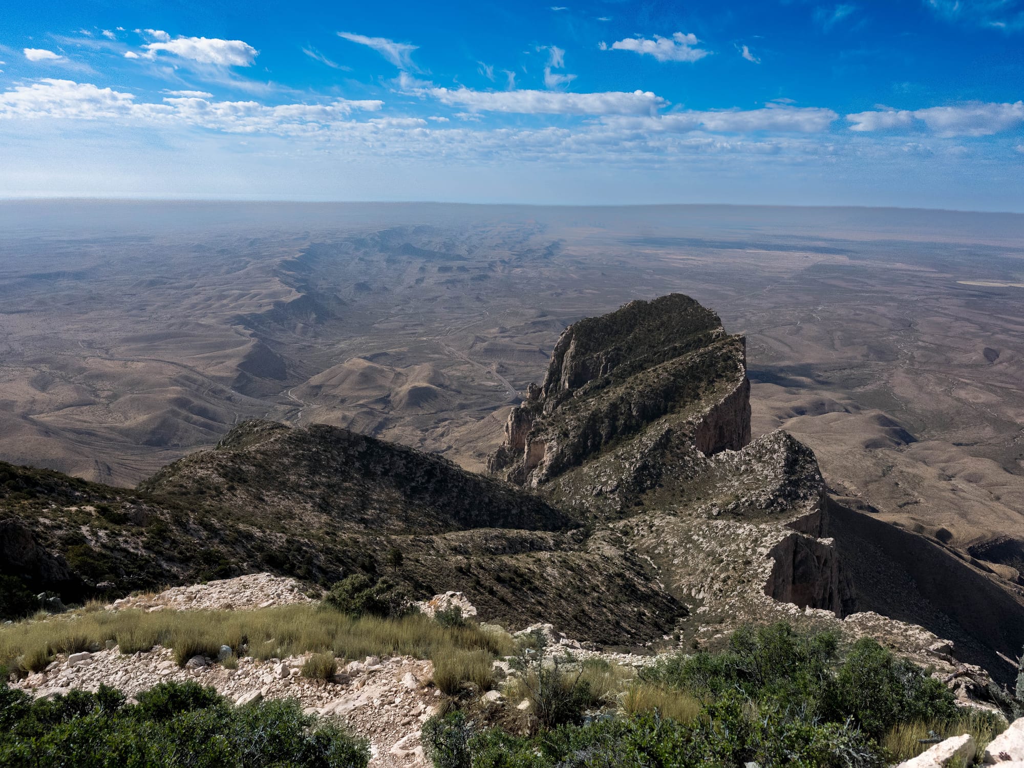
Guadalupe Peak is one of those hikes where the summit stays hidden until the end.
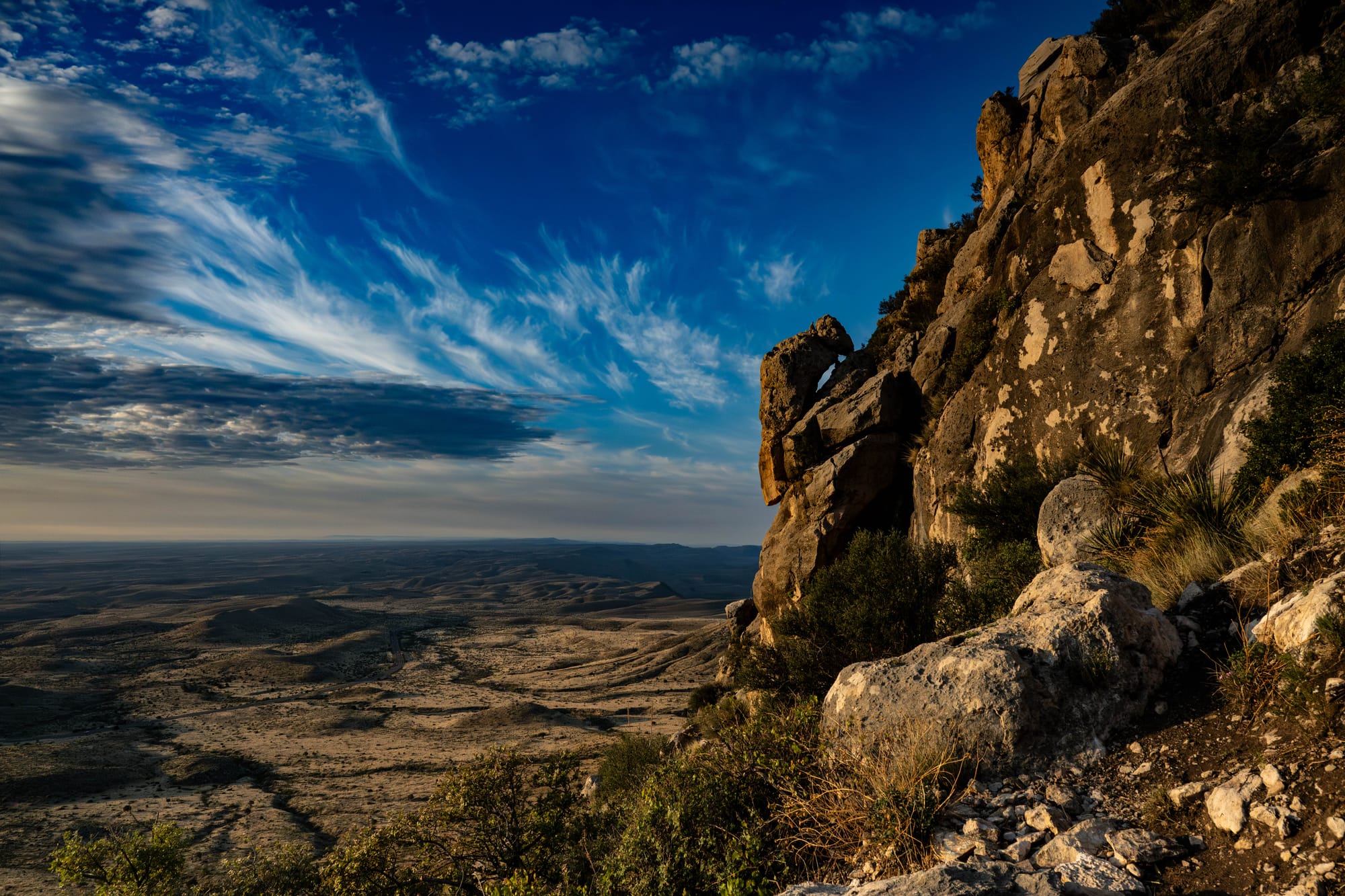
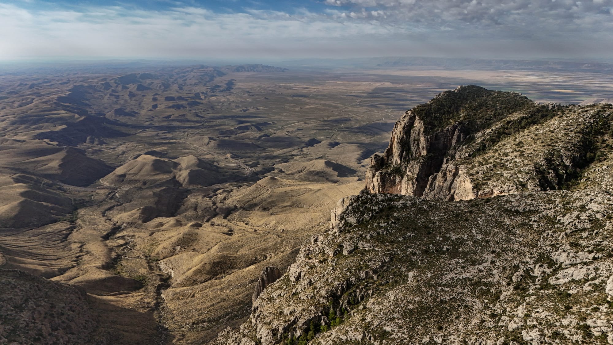
The views keep improving as you climb, but the top never fully announces itself. There is a false summit, a few final switchbacks, and then the view opens.
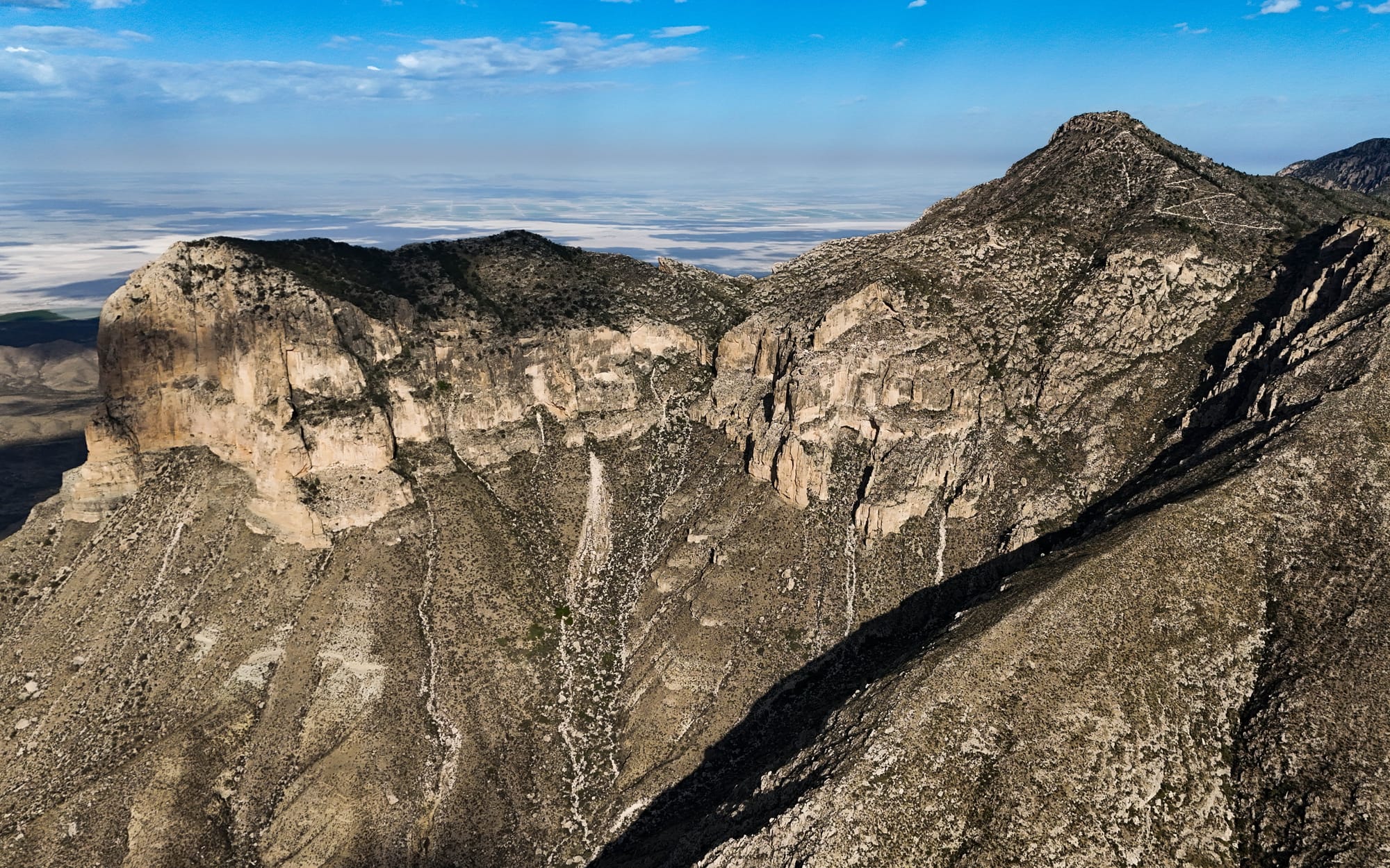
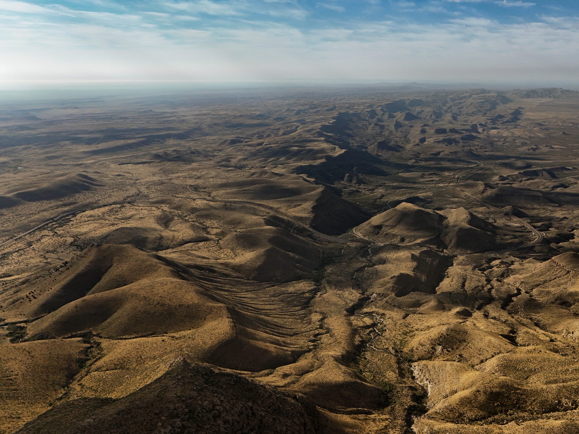
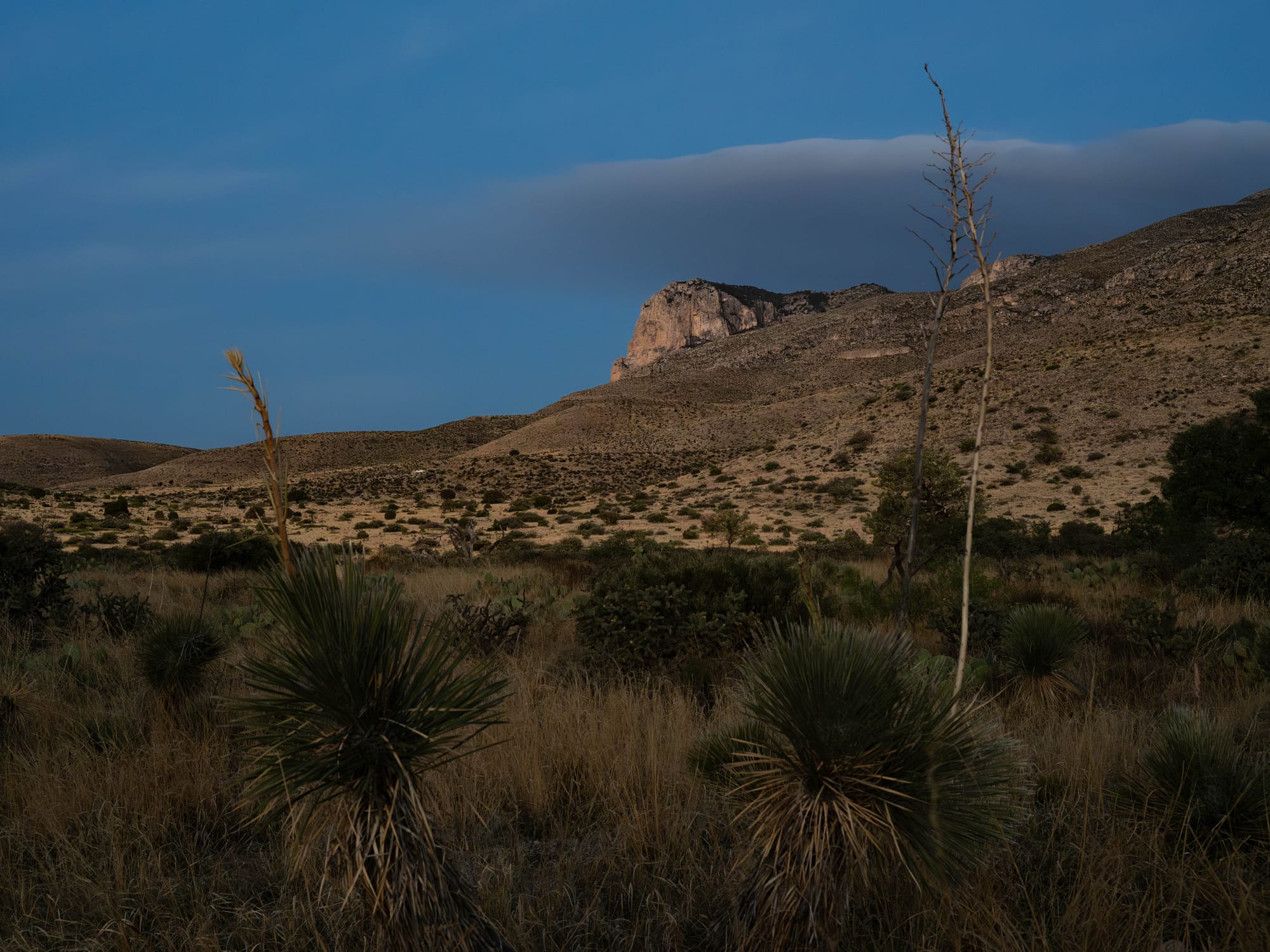
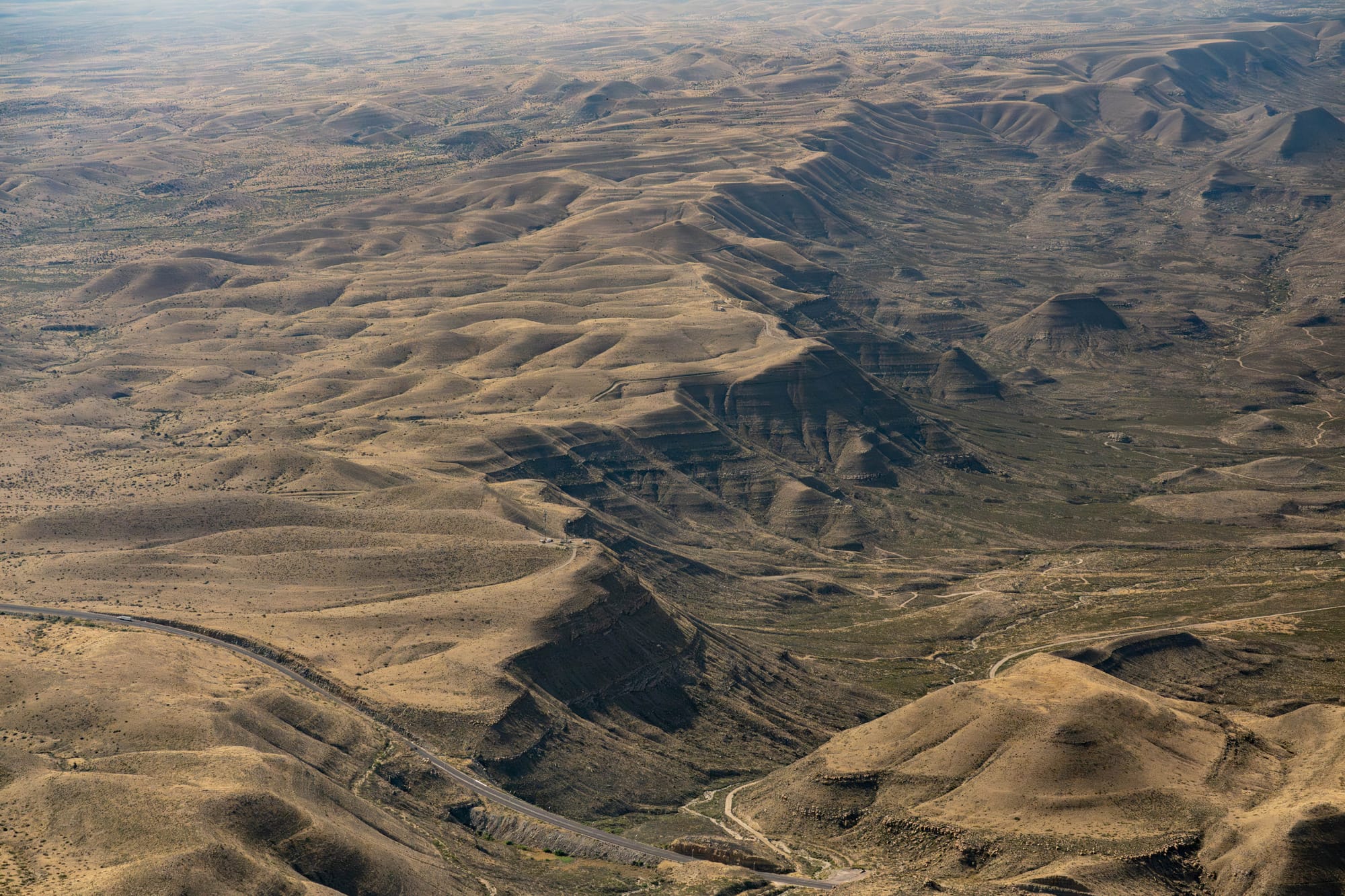
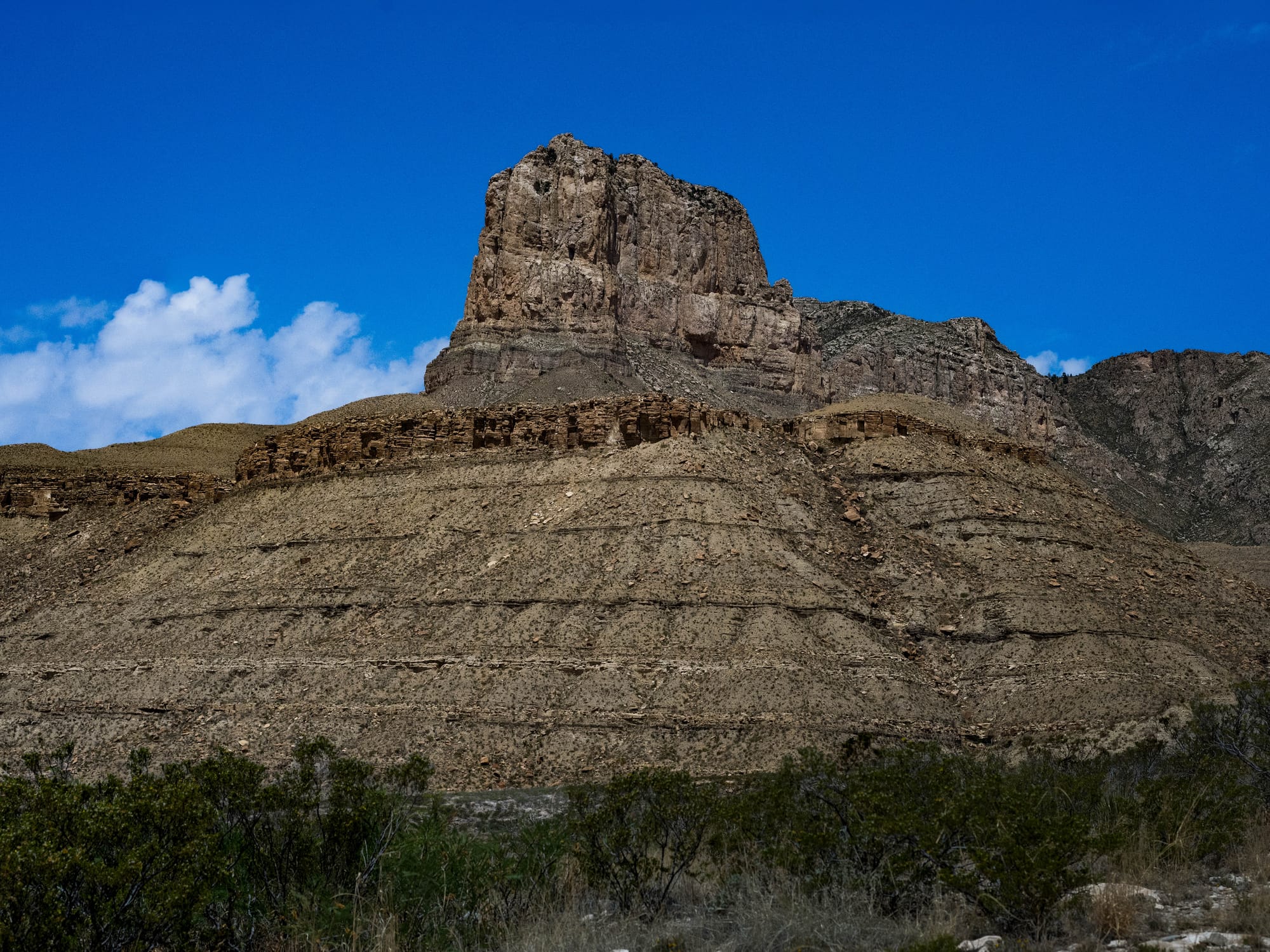
El Capitan sits below and out in front of you. Beyond it, the desert spreads south and west, with the salt flats, distant ranges, and open basin visible in clear light.
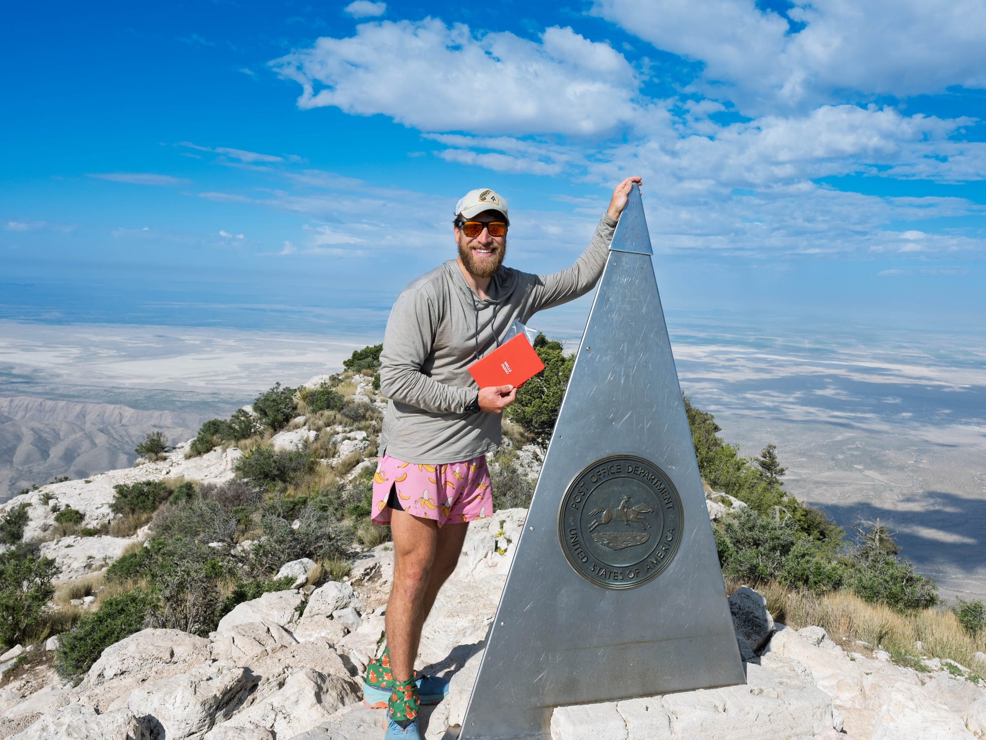
The summit itself has an unusual marker: a stainless steel pyramid with American Airlines and U.S. Postal Service references. There was also a logbook tucked underneath, so I signed in before taking time with the view.
Photography shaped a lot of the day. Most of the morning was about chasing light and shadow without blowing out the bright spots. Sunrise, ridgelines, switchbacks, desert floor, changing angles.
After the hike, I drove to both scenic viewpoints and set up the camera for a few more images. I also flew the drone and got panoramic views that helped show the scale better than the trail photos alone.
Guadalupe Highlights
Guadalupe Peak is the highest point in Texas, but that is only the surface-level fact.
The deeper story is that the mountain is part of an ancient reef.
Around 275 to 277 million years ago, this area sat beneath the Delaware Sea, an arm of the larger Permian Basin. Along its edge, reef material accumulated and hardened into the Capitan Reef complex. Today, that fossil reef forms the core of the Guadalupe Mountains.
This is not a coral reef in the modern sense. The Capitan limestone was built from algae, sponges, bryozoans, and other invertebrate skeletons, later stabilized and cemented into reef rock.
At Carlsbad Caverns, the reef is the material the cave formed within. At Guadalupe Mountains, the reef is exposed as cliffs, ridgelines, and peaks. One day we were inside the system. The next day I was climbing over it.
That also explains why the mountains rise so abruptly from the surrounding desert. They are not just isolated peaks. They are the exposed edge of a massive Permian reef system, lifted and eroded into the current landscape.
Guadalupe Peak reaches 8,751 feet, making it the highest natural point in Texas. The trail climbs about 3,000 feet over 8.8 miles round trip, which gives the hike enough bite without turning it into a sufferfest.
Final Takeaways
Guadalupe Peak was one of the best hikes I’ve done since we started Airstreamin'.
It had the right mix: early light, steady climbing, changing terrain, clear views, and enough geology behind it to make the landscape feel connected to everything we had just seen at Carlsbad.
The summit was worth it, but the real value was how the hike made the region make more sense.
Carlsbad showed the reef from within.
Guadalupe Peak showed it from above.
I would come back without hesitation. There are too many trails, ridges, and summits in that park left to explore.