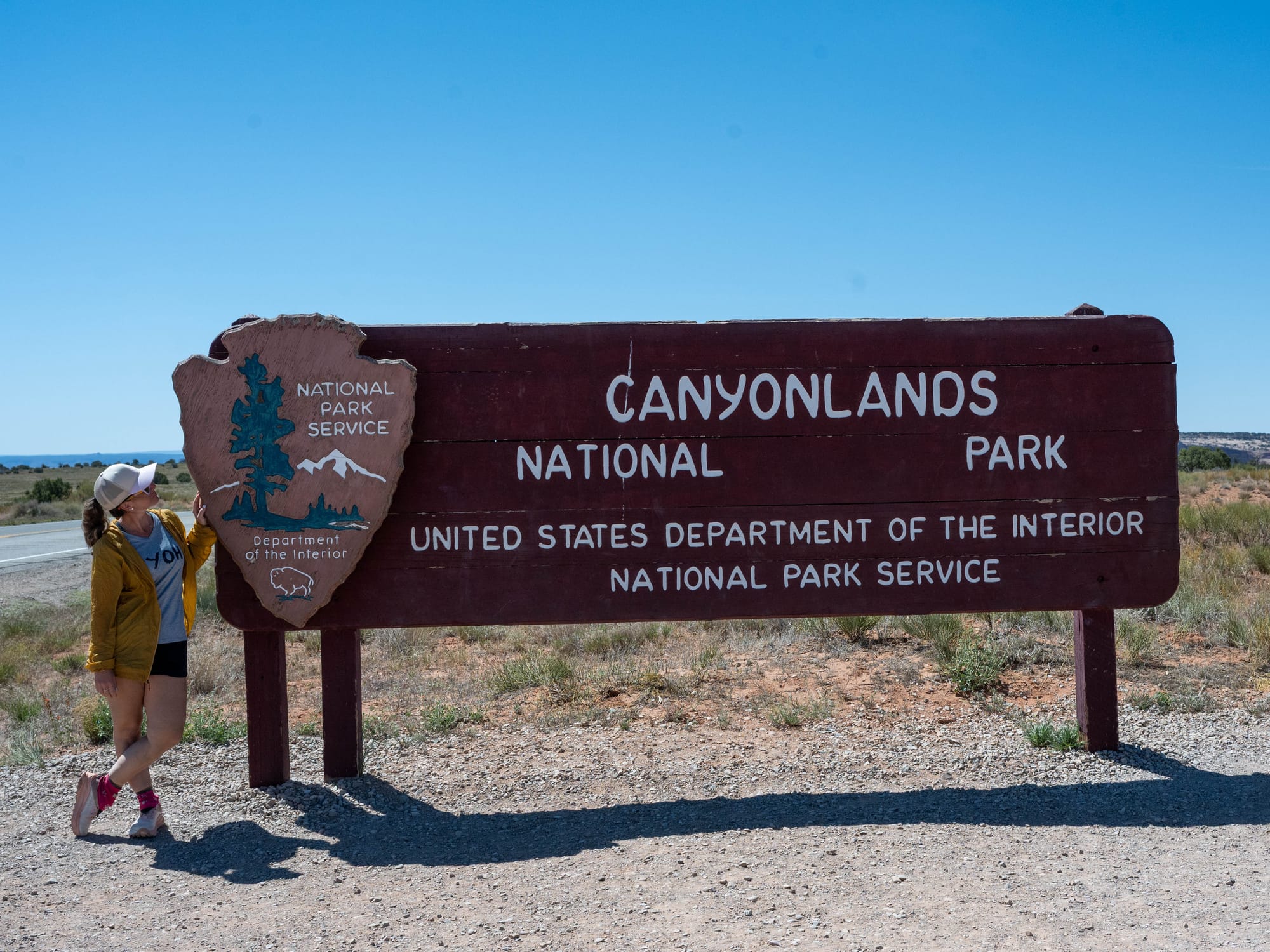
Canyonlands National Park | Island In The Sky
Canyonlands is harder to summarize than most places around Moab.
Arches gives you obvious landmarks. You can point to a window, a balanced rock, or a sandstone arch and understand why people stop there. Canyonlands works differently. The main feature is not one object. It is the system: rims, benches, canyons, rivers, roads, buttes, mesas, and layers of rock stacked across a huge desert landscape.
It takes longer to understand because the scale keeps getting in the way.
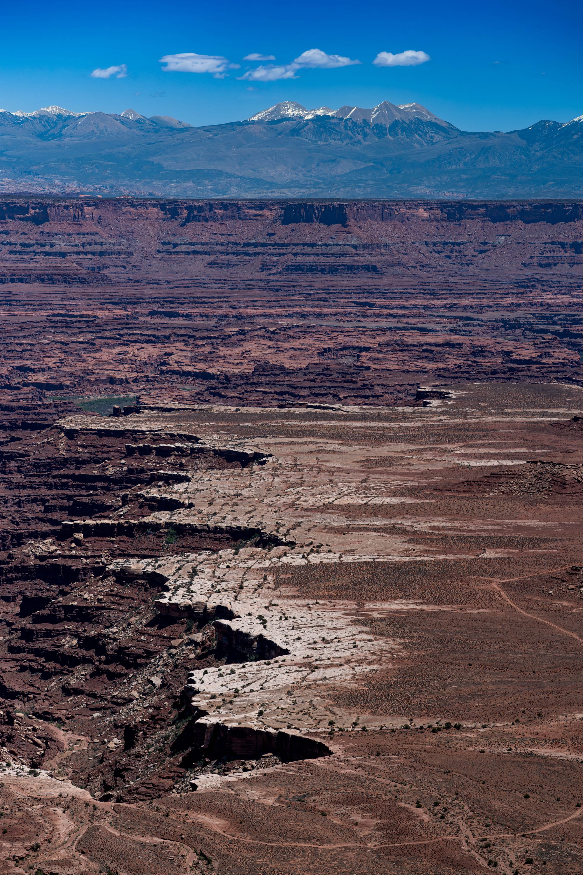
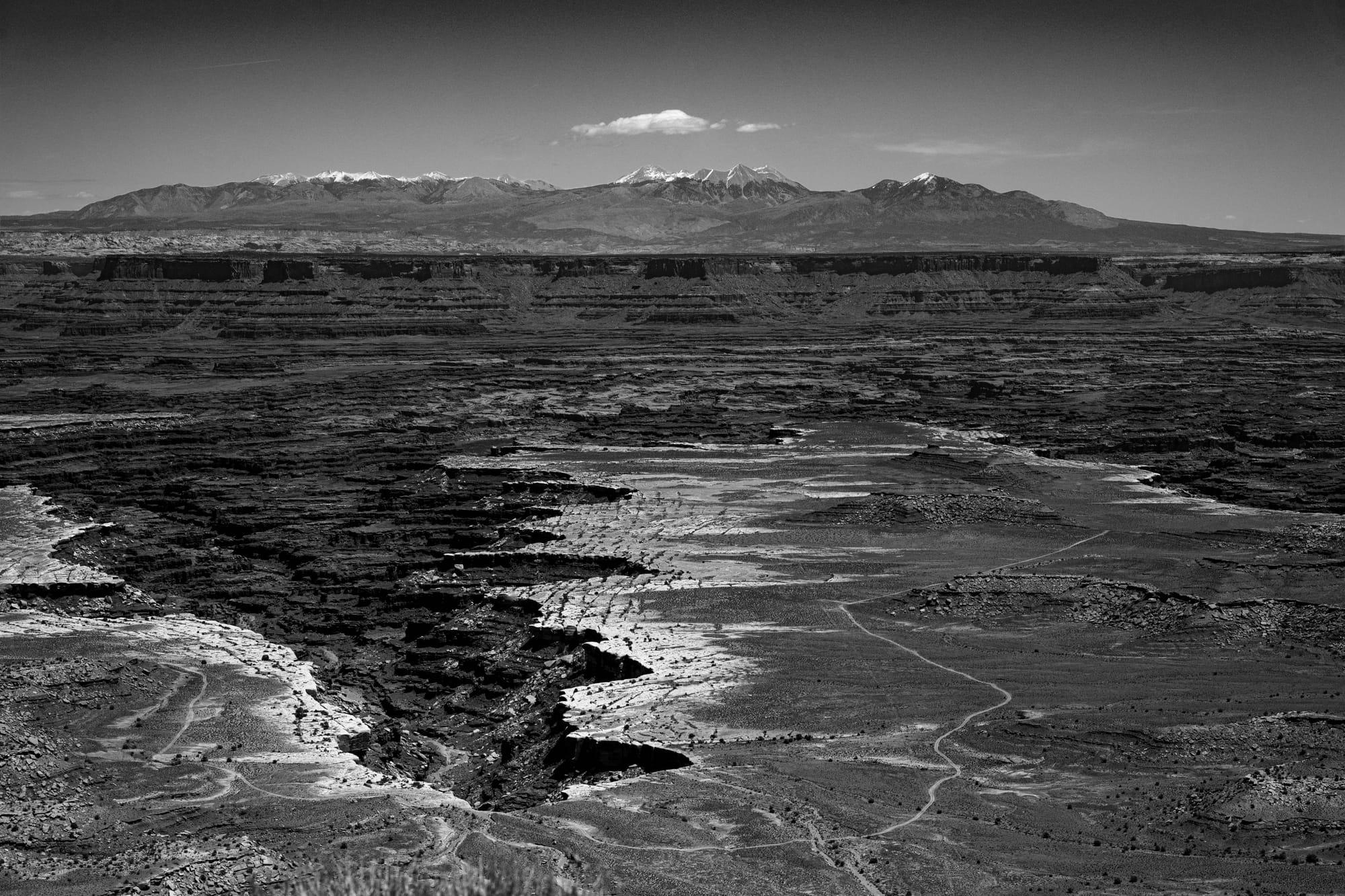
At Island in the Sky, you stand on a mesa more than a thousand feet above the surrounding terrain, looking across canyon country carved by the Colorado and Green Rivers. Every overlook gives you a different angle, but none of them explain the whole park at once.
That ended up being the best part.
Canyonlands did not feel like a park we checked off. It felt like a place we had just started learning how to read.
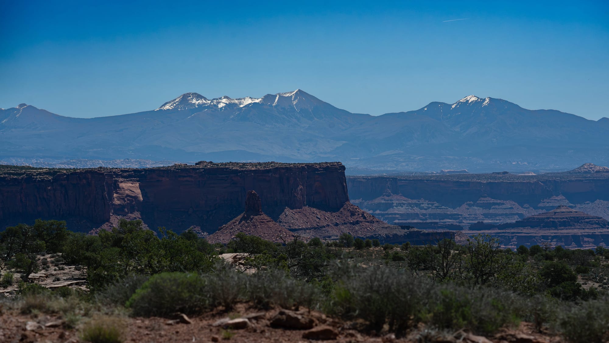
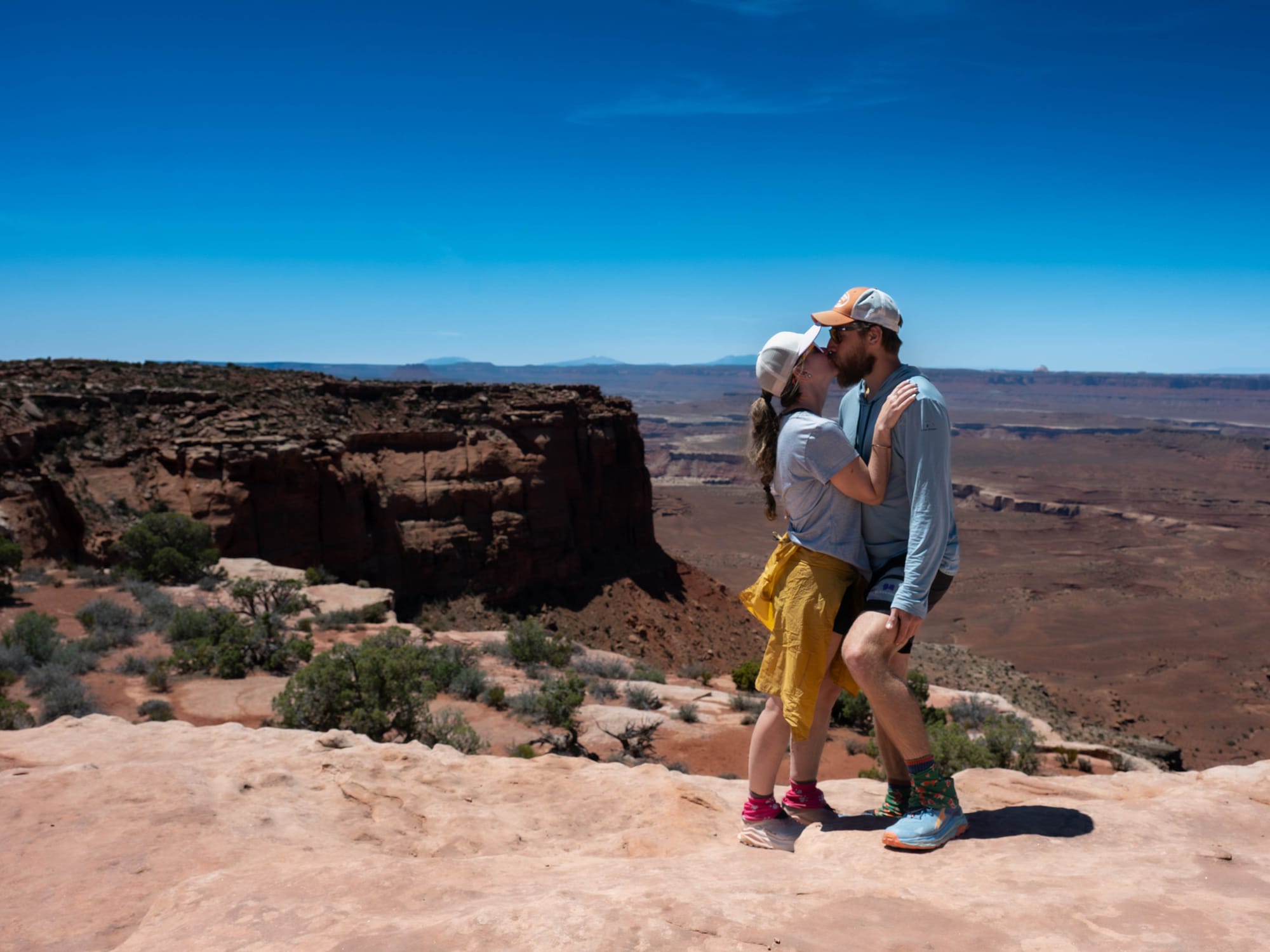
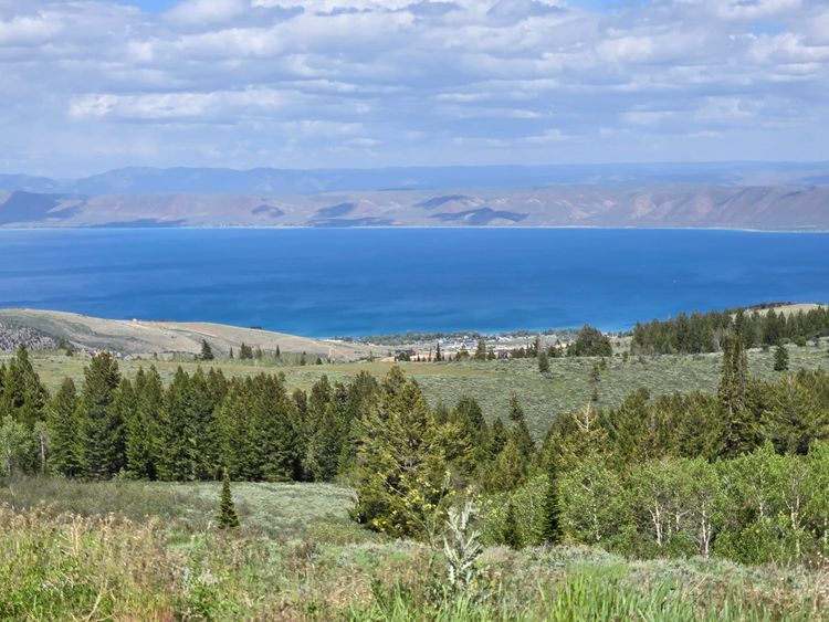
The view from UT-313 is stunning
🗺️ The Lay of the Land
- Location: Canyonlands National Park · Island in the Sky District · 38.4598, -109.8207 · [Google Maps]
- Official site: Canyonlands National Park
- Landscape: canyon country · high desert
- Vibe: wide views, layered rock, and slow geography
- Our stay & conditions: May 2026 · day visits from Moab · dry, clear, and exposed
We visited Canyonlands from Moab and focused on the Island in the Sky district.
On my longer visit, I drove the main park road all the way to Grand View Point Overlook, stopping at several overlooks along the way. From there, I hiked out to the end of the overlook trail and took a wide panorama across the canyon system.
After that, I worked back north and made stops at Buck Canyon Overlook, Aztec Butte, Whale Rock, and then went out to Upheaval Dome before heading back toward Moab.
After our hike at Dead Horse Point, Sam, the dogs, and I made another lap through the park. We drove back to Grand View Point, stopped at Green River Overlook, and went out toward Upheaval Dome again so Sam could see the park since we were already most of the way there.
We skipped Mesa Arch on purpose.
That one feels like a future sunrise visit, ideally with Sam and the camera ready.
Canyonlands Demands a Different Kind of Attention
Canyonlands sits close enough to Arches that it is easy to group them together, especially if you are staying in Moab. But the two parks ask you to look in different ways.
Arches gives you individual formations that are easier to name, frame, and walk toward. Canyonlands is more spread out. The subject is scale: rims, benches, drainages, rivers, roads, buttes, and canyons all working together.
It is not as immediate, but it gets better the longer you look.
Island in the Sky is the easiest district to visit from Moab, and feels enormous. The park is divided into four districts: Island in the Sky, The Needles, The Maze, and the rivers. No roads connect the districts inside the park. Canyonlands is not one compact unit. It is a landscape split by water, distance, and access.
This post only covers one district, Island in the Sky.
We did not explore The Needles. We did not reach The Maze. We did not drive the White Rim or Shafer Trail, even though both immediately went onto the future list. What we got was a first reading of the park from the mesa top.
And even that was a lot.
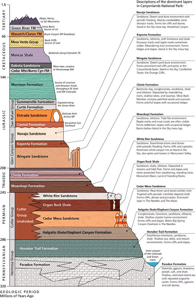
320 Million Years: Layers First, Canyons Later
The easiest way to understand Canyonlands is to start with the layers.
Before this was canyon country, sediment was being deposited across old environments: deserts, beaches, rivers, floodplains, mudflats, and shallow seas. Over time, those sediments hardened into rock. Later, the Colorado Plateau rose.
As the land lifted, the Colorado and Green Rivers began cutting down through that stack of rock, exposing buried layers and creating the canyon system we see now.
First came the layers. Then came the lift. Then came the cutting.
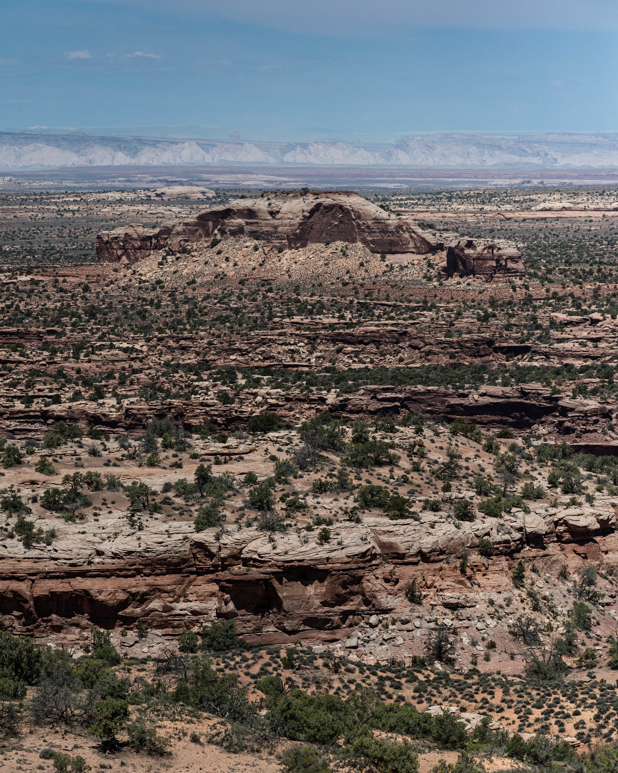
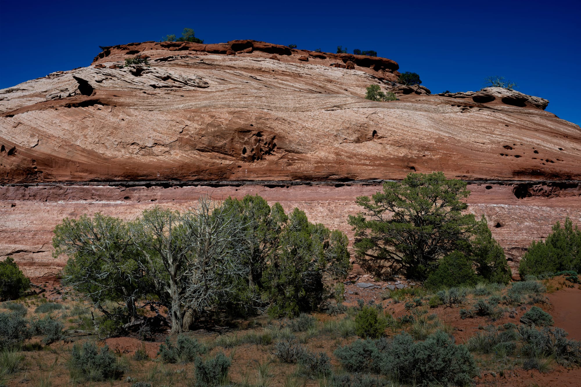
The canyon walls are not one kind of rock. They are a stack of different materials responding to erosion in different ways. Some layers are harder and form cliffs, shelves, or caprocks. Softer layers wear away more easily and form slopes. That difference is what gives Canyonlands its stair-step look.
Once you know that, the views start to change.
You stop seeing one giant canyon and start seeing a sequence: rim, slope, bench, cliff, wash, river, and repeat.

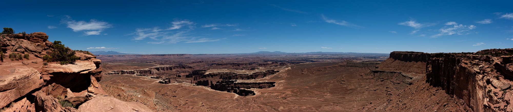

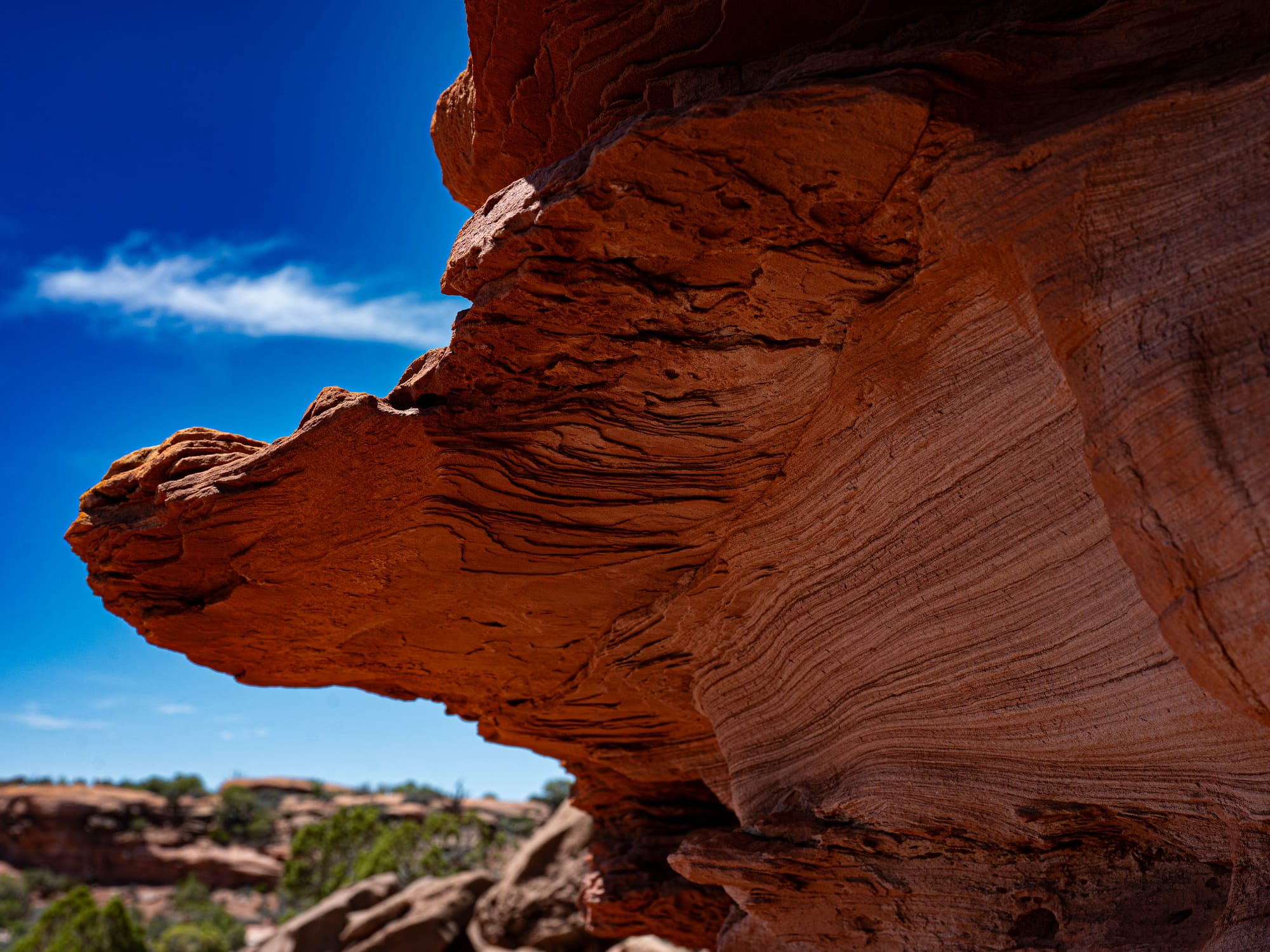
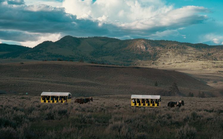
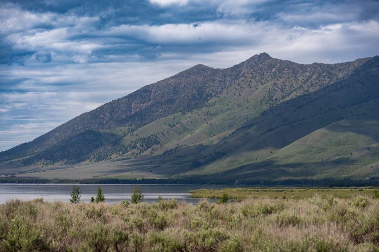
Scenes from Island in the Sky: canyon rims, desert blooms, mesa tops, and the Colorado River cutting through the layers below.
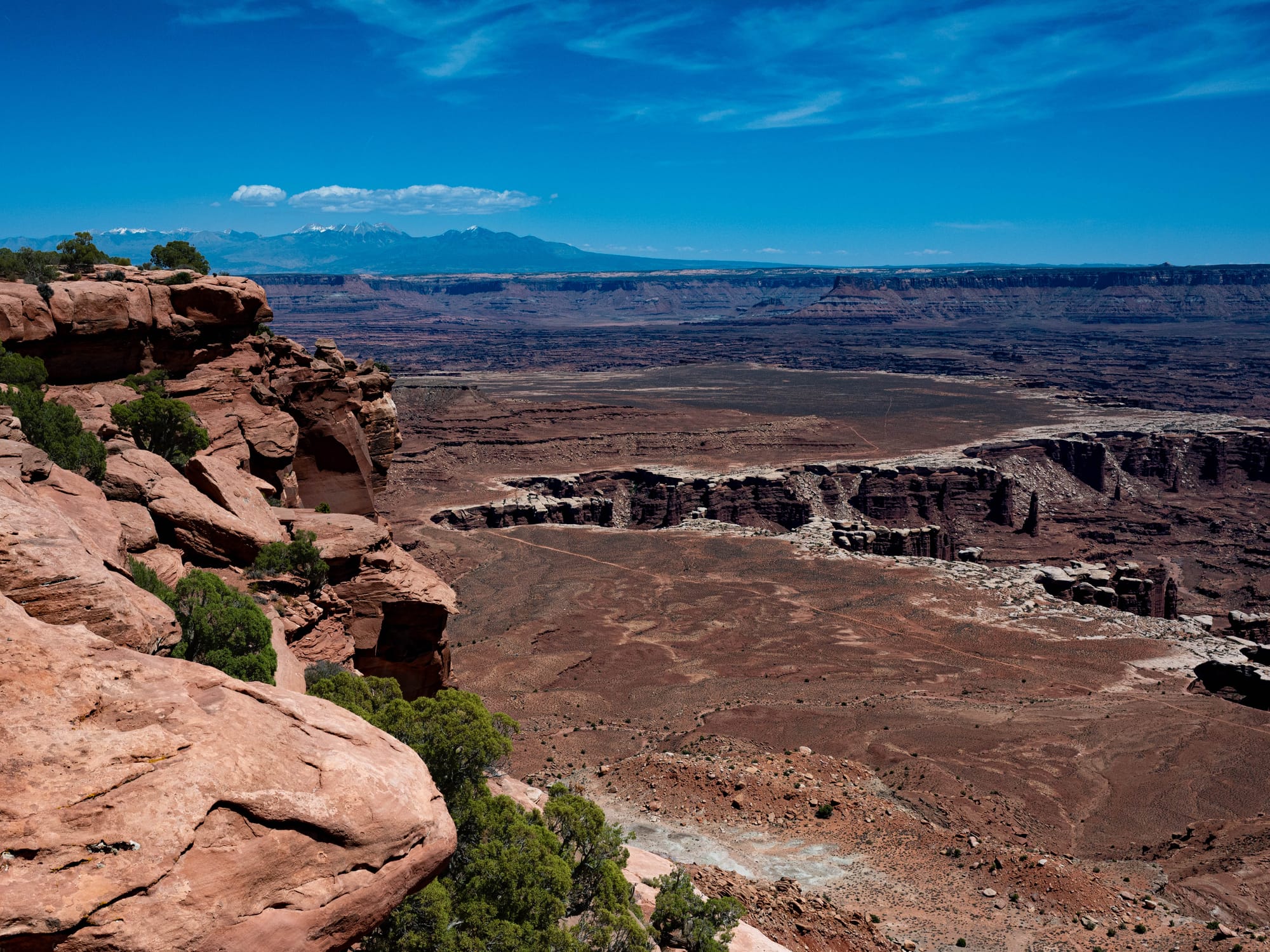
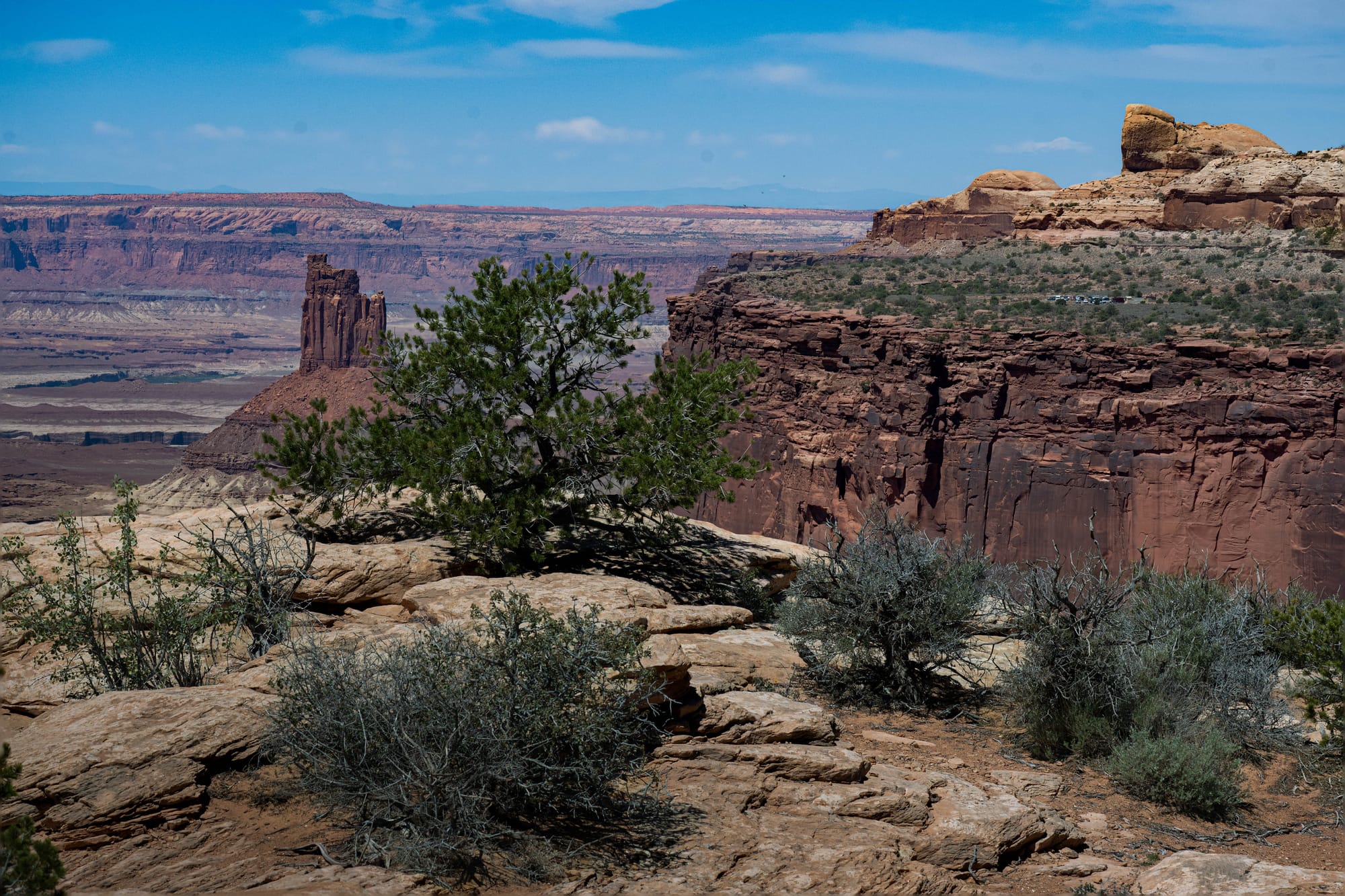
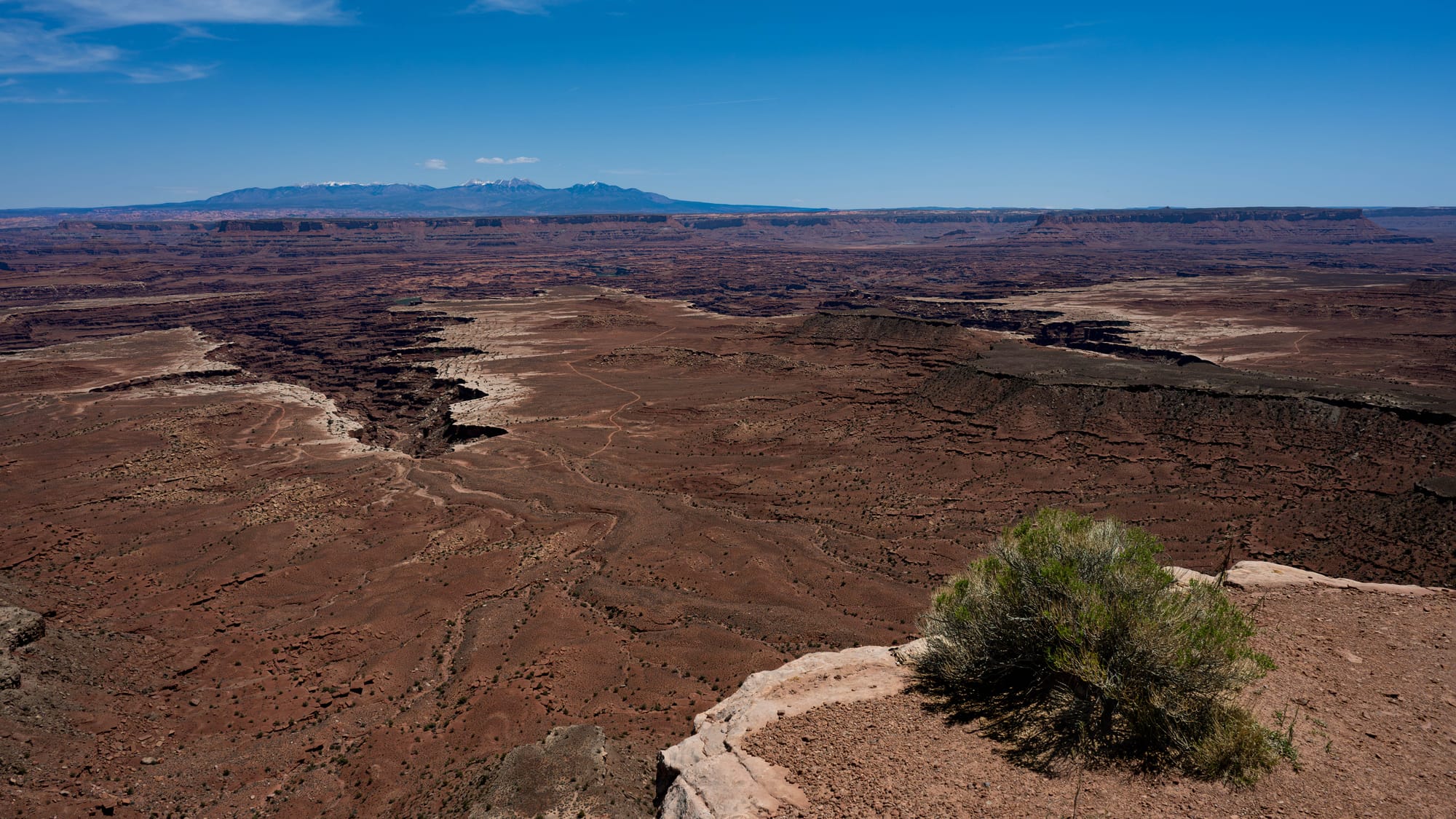
The Rim
Grand View Point is a good place to understand why Island in the Sky has its name.
You are not standing inside the canyon. You are standing above it, on a high mesa with cliffs falling away in multiple directions. The paved viewpoint is impressive, but the ~1 mile trail beyond it is worth taking.
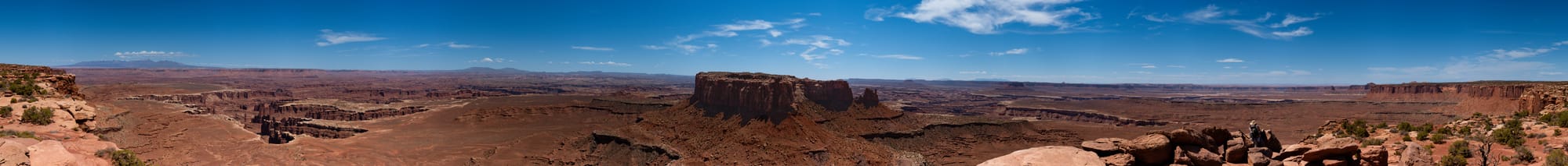
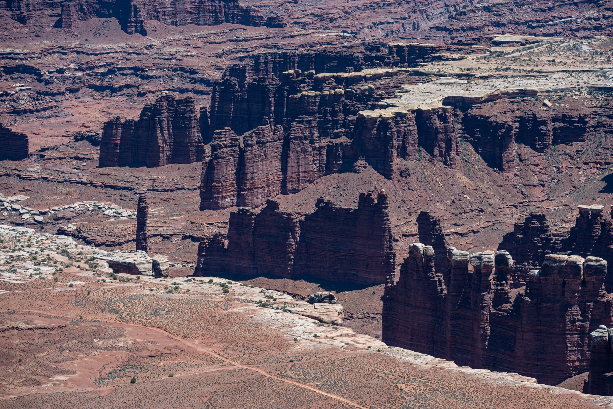
From the rim, you can see roads and formations far below, but distance gets weird. Big things look small. Canyons overlap each other. The landscape keeps layering itself until it becomes hard to tell where one feature ends and another begins.
That is part of what makes the park hard to photograph.
A single image can capture the color and width, but it struggles with the depth. Standing there, you can feel the drop between where you are and what you are looking at. In a photo, the whole place wants to flatten.
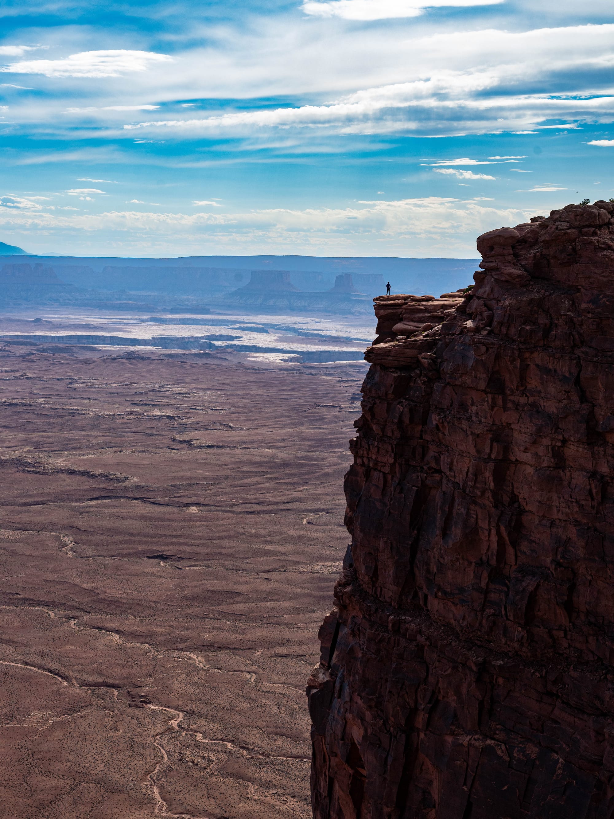
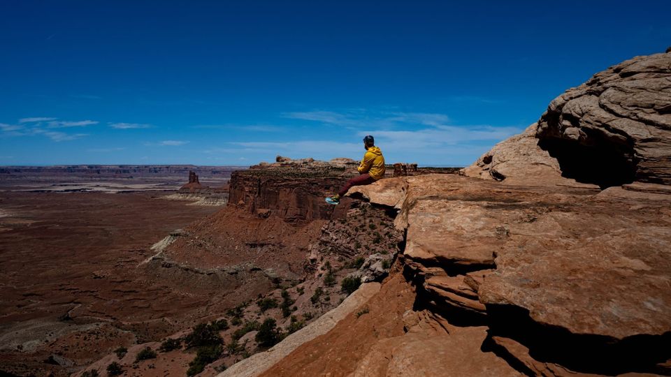
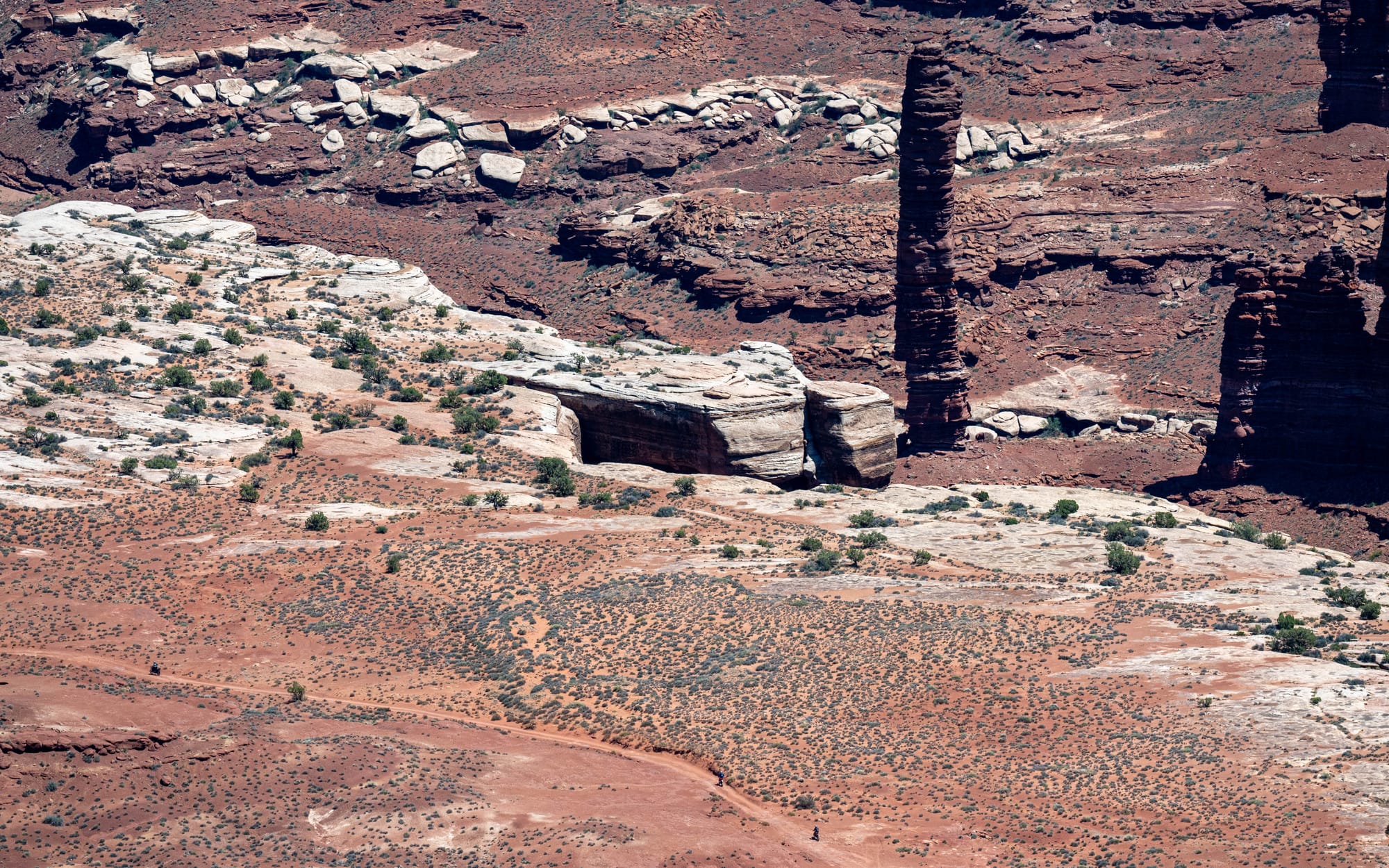
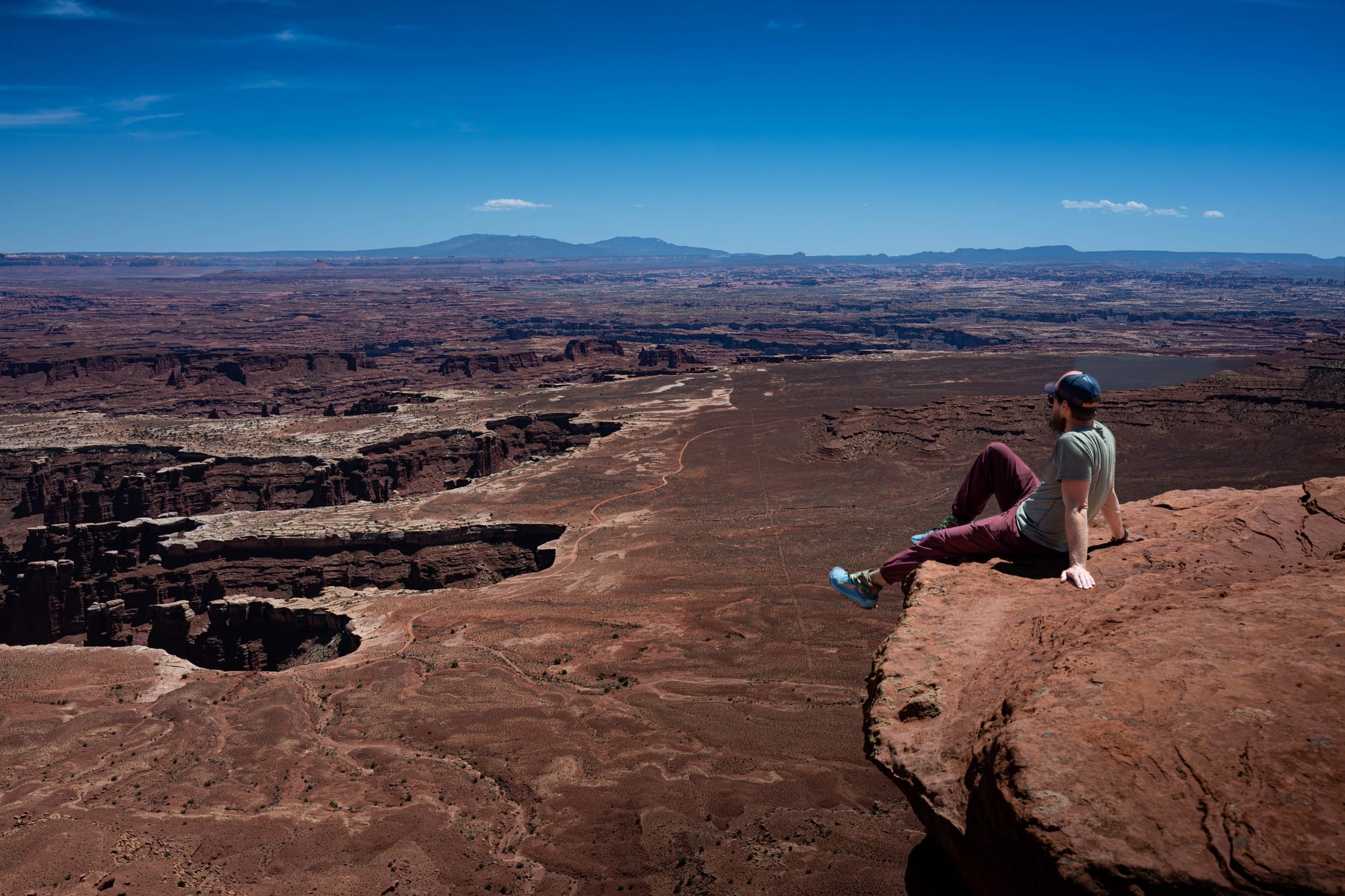
Canyonlands: Where Humans are Tiny
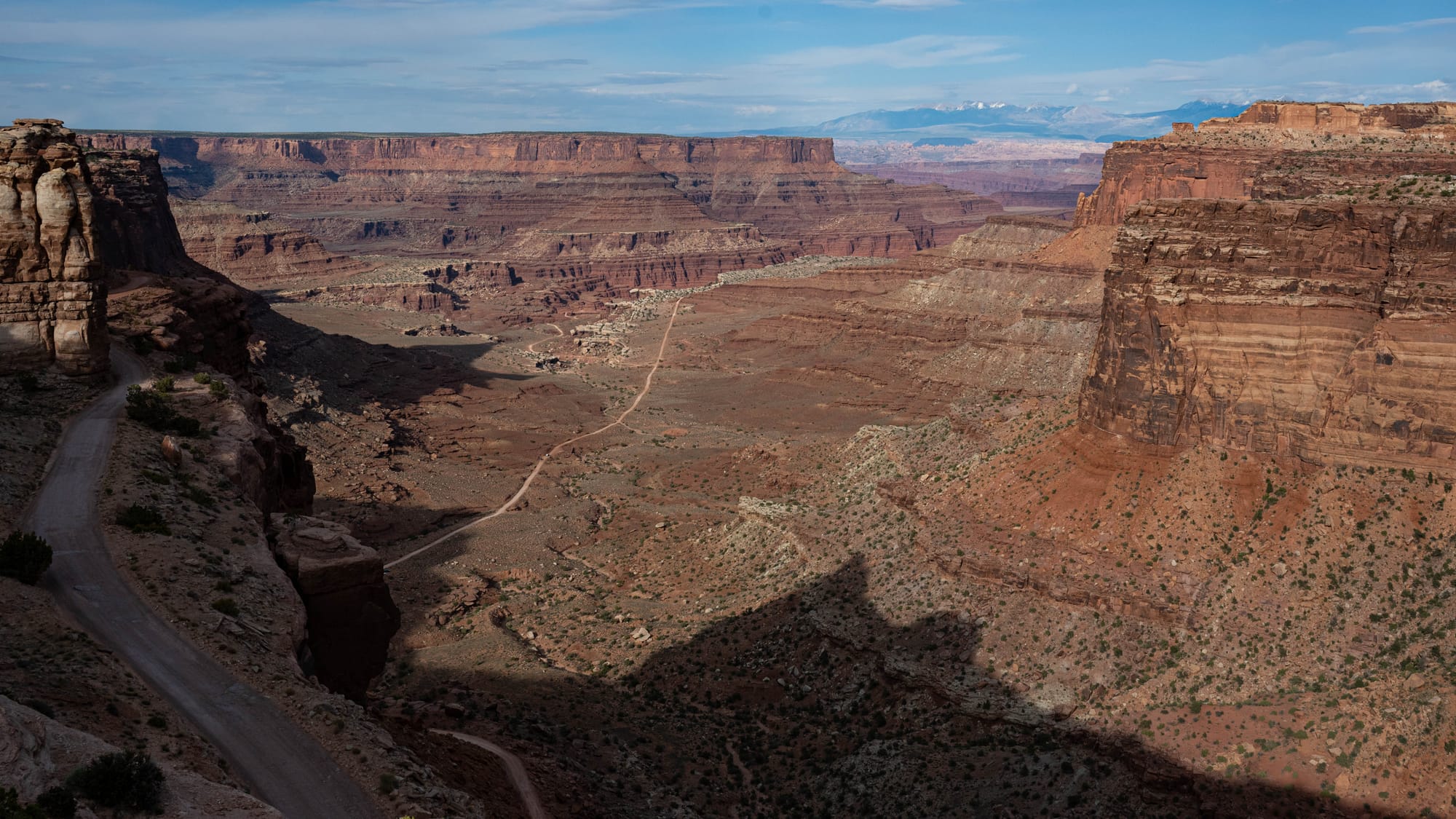
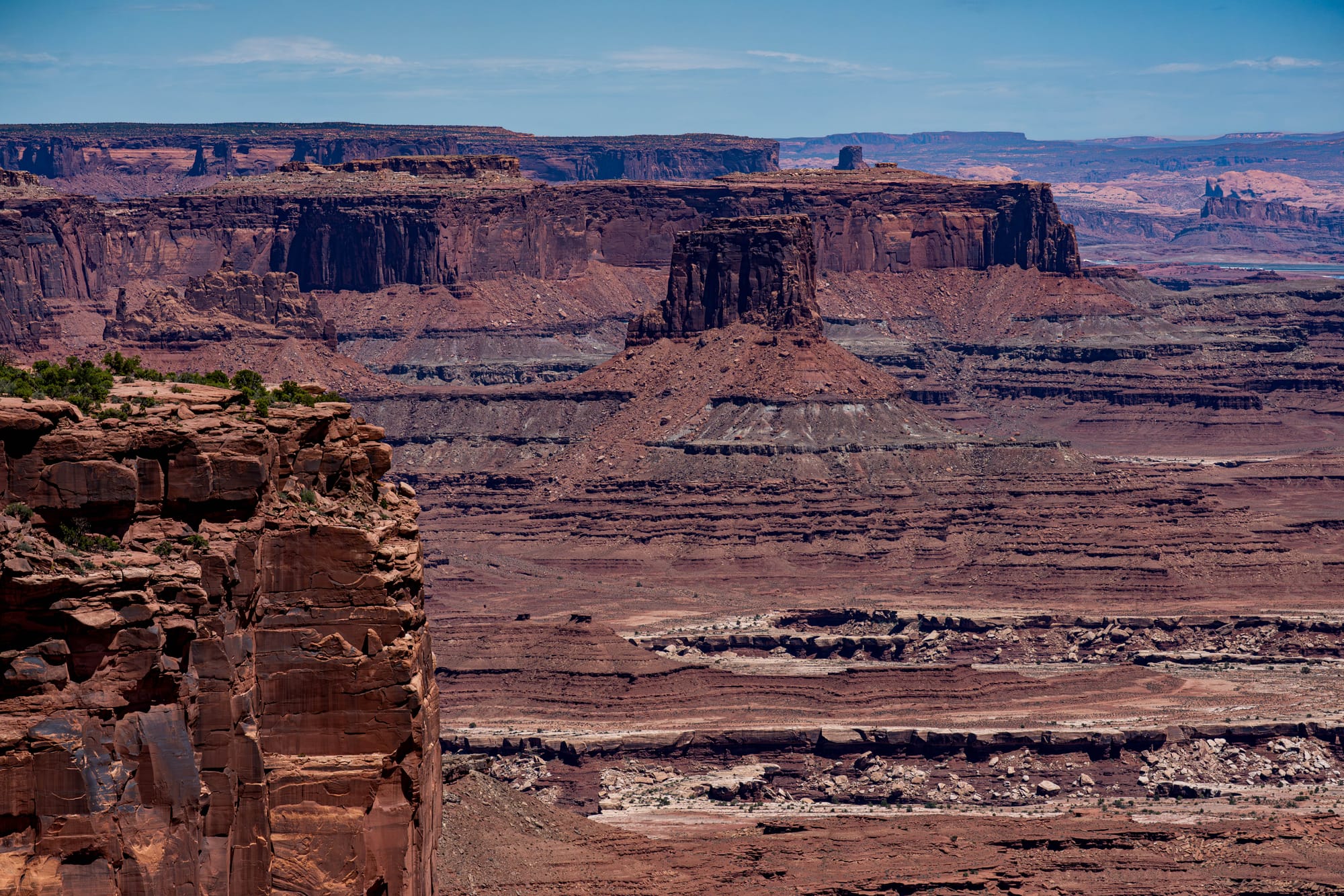
The White Rim
One of the most iconic features at Island in the Sky is the White Rim.
From above, it often appears as a pale bench below the mesa top and above the deeper river canyons. It is not just a color change.
The White Rim Sandstone, deposited during the Permian Period, roughly 245 to 286 million years ago, is a resistant layer that forms cliffs and caprocks around the inner canyons.
It also helps explain why Canyonlands looks terraced.
Instead of one clean drop from rim to river, the landscape steps down through benches and cliffs. The White Rim creates one of those steps. It is also where the White Rim Road runs, looping through a part of the park that feels close from above and very far in practical terms.
We did not drive it on this trip, but it went onto the list immediately.
Same with Shafer Trail. Seeing those roads from above changes how you think about the park. Canyonlands is not just overlooks. There are routes down there, threading through the layers.
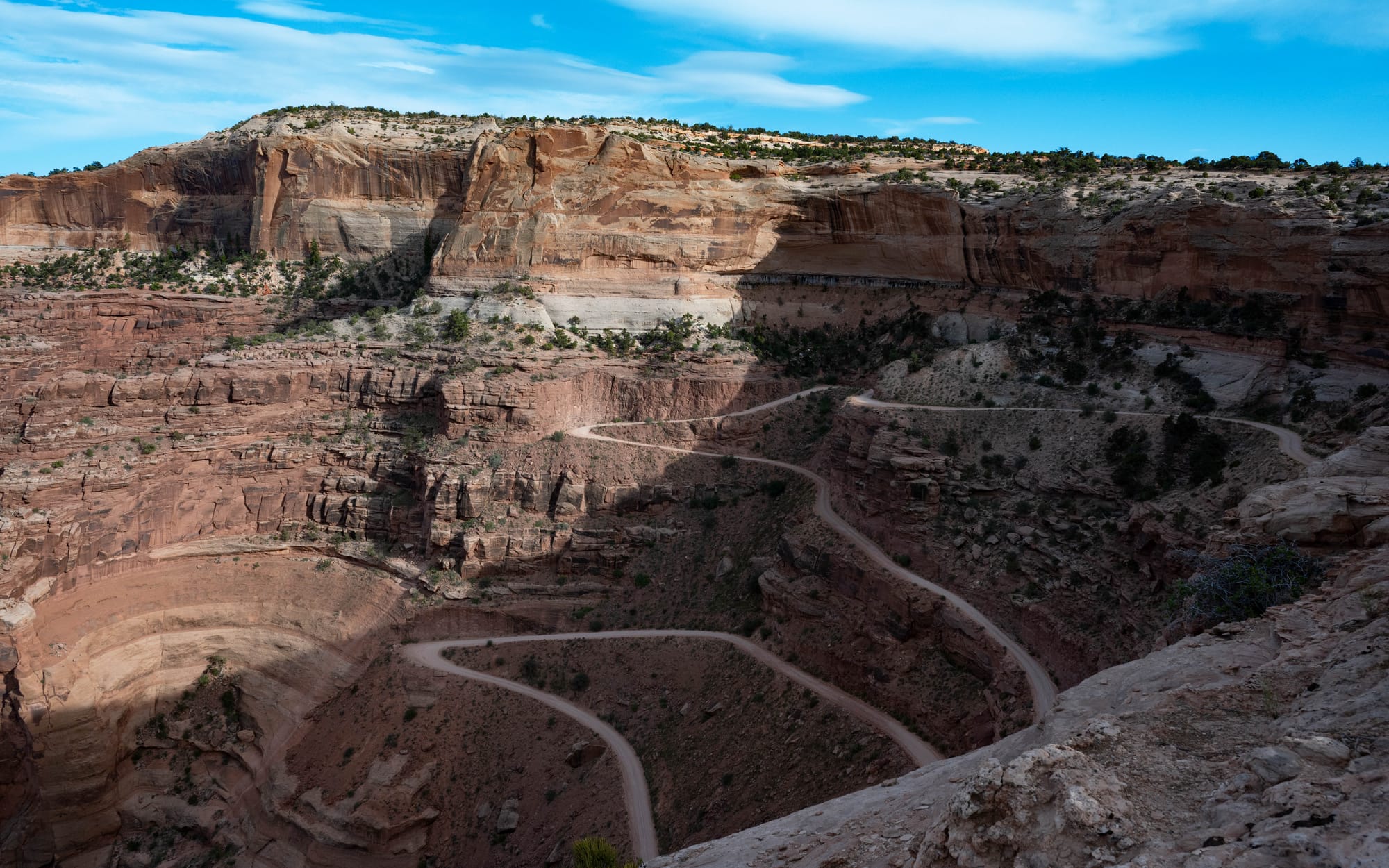
Head down the Shafer Trail to 100+ miles of roads circling the White Rim.
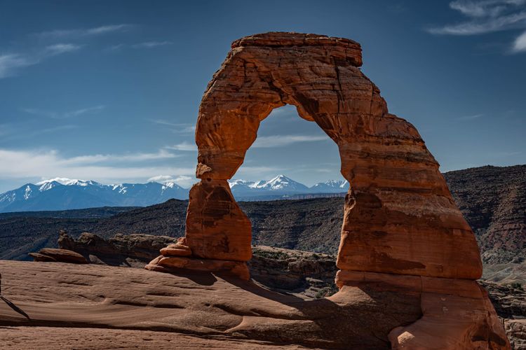
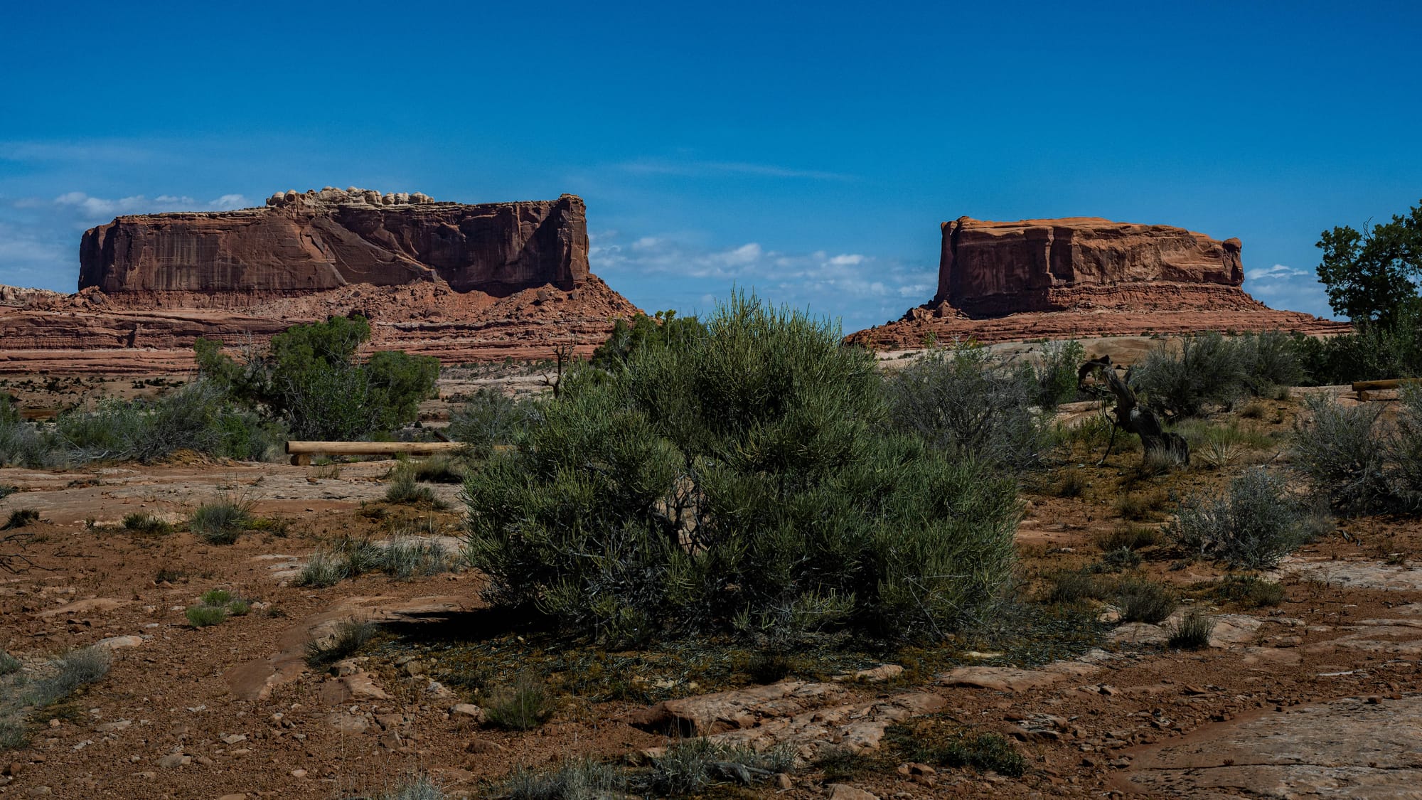
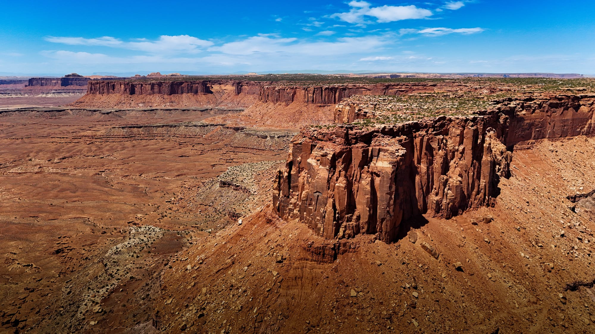
Buttes, Mesas, and Canyons
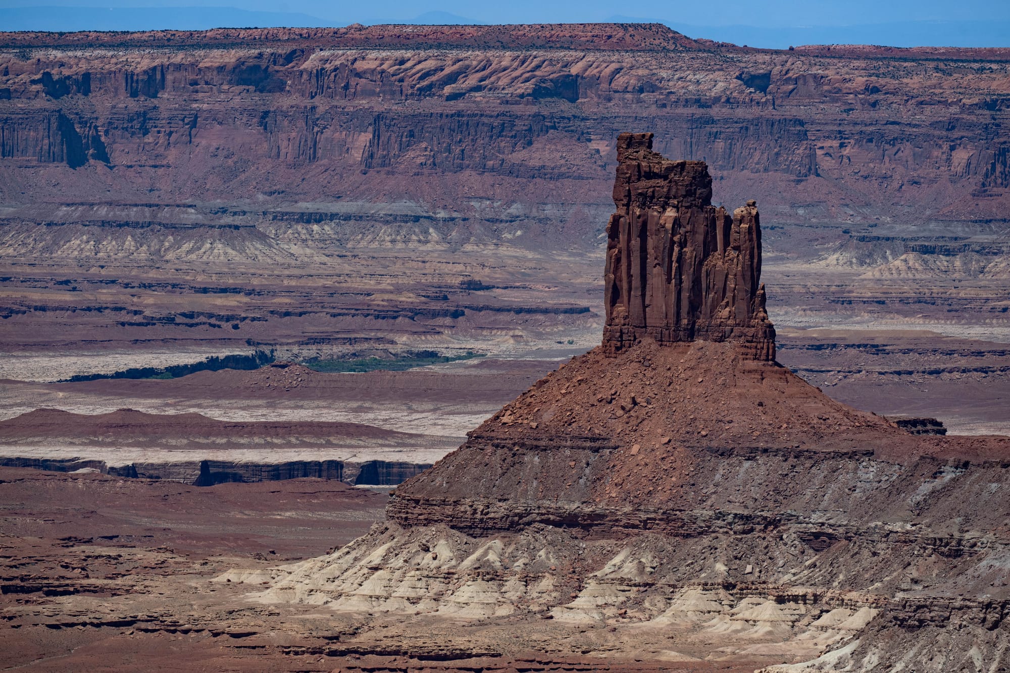
Canyonlands' landforms are easier to understand once you start naming the shapes.
A mesa is a broad, flat-topped high area. A butte is similar, but smaller and more isolated. A canyon is the cut made by water moving through the rock. The towers, spires, and knobs scattered through the views are leftovers of erosion, pieces that have not yet been removed.
This landscape is not being built upward. It is being taken apart. Water, wind, freeze-thaw cycles, heat, gravity, and time keep removing material. The forms that remain look like monuments, but they are really temporary pauses in a much longer process.
The park feels permanent because the scale is so large, but Canyonlands is an active landscape. The changes are just happening on a timeline longer than a visit can show.
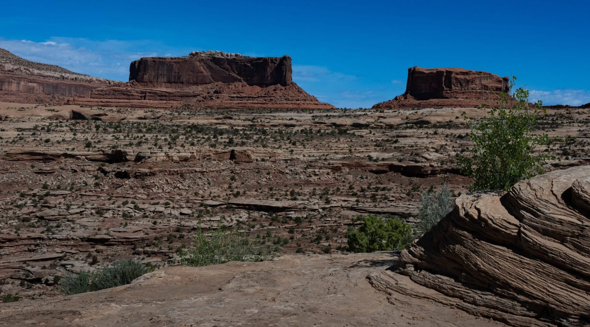
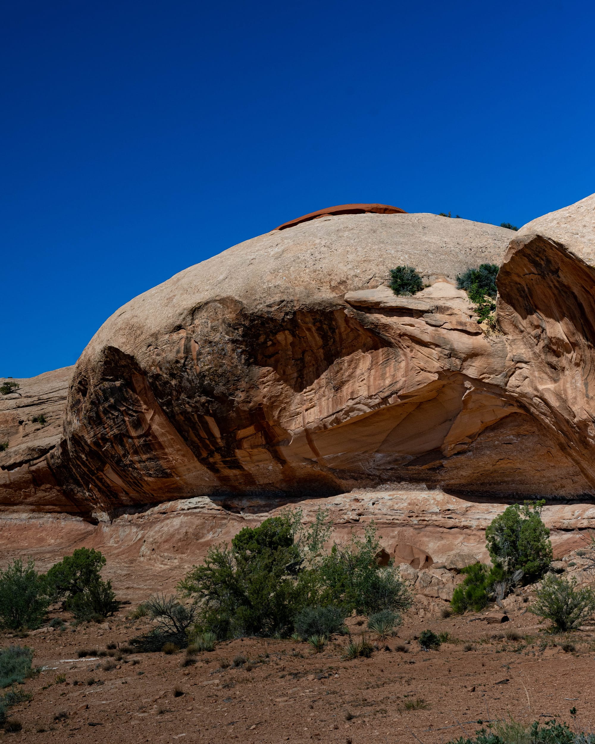
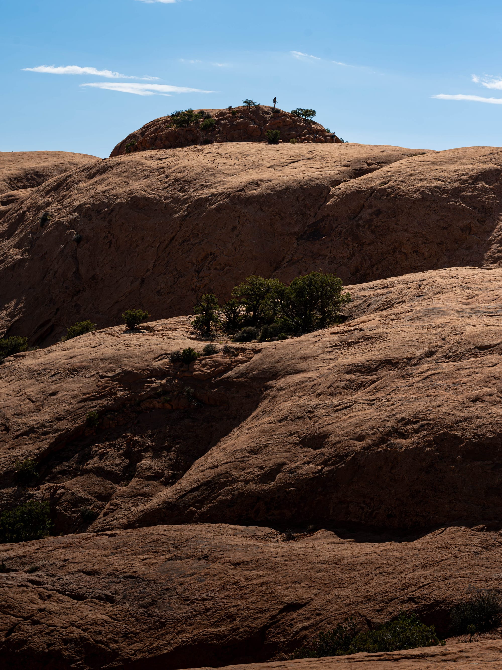
Monitor & Merrimac Buttes tower 600' above the sandstone base | Mesas above the white rim | Aztec Butte Sandstone
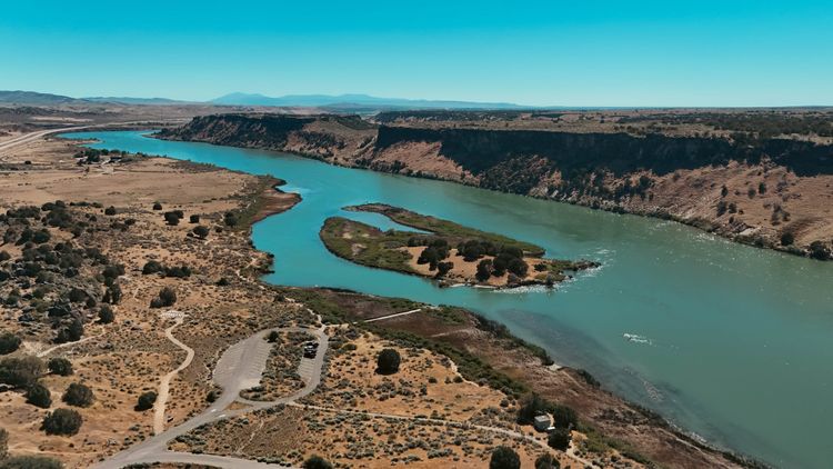
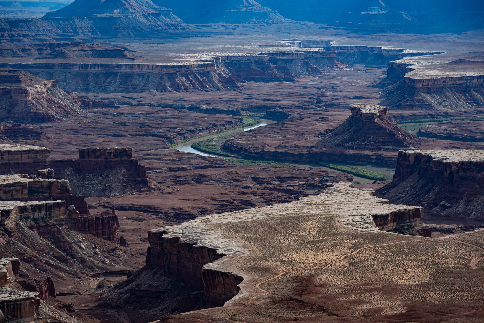
Rivers, Water, and Time
Water is the part of Canyonlands that is easy to underestimate.
From Island in the Sky you are high above the rivers. Sometimes you can see them directly. But not always. NPS describes Canyonlands as a wilderness of canyons, buttes, and spires carved by rivers, with the rivers dividing the park into its districts.
Roads do not define Canyonlands. The rivers do.
Water is scarce, but it is the main character. It cuts the canyons, gathers life along the river corridors, and leaves the high desert looking even drier by comparison.
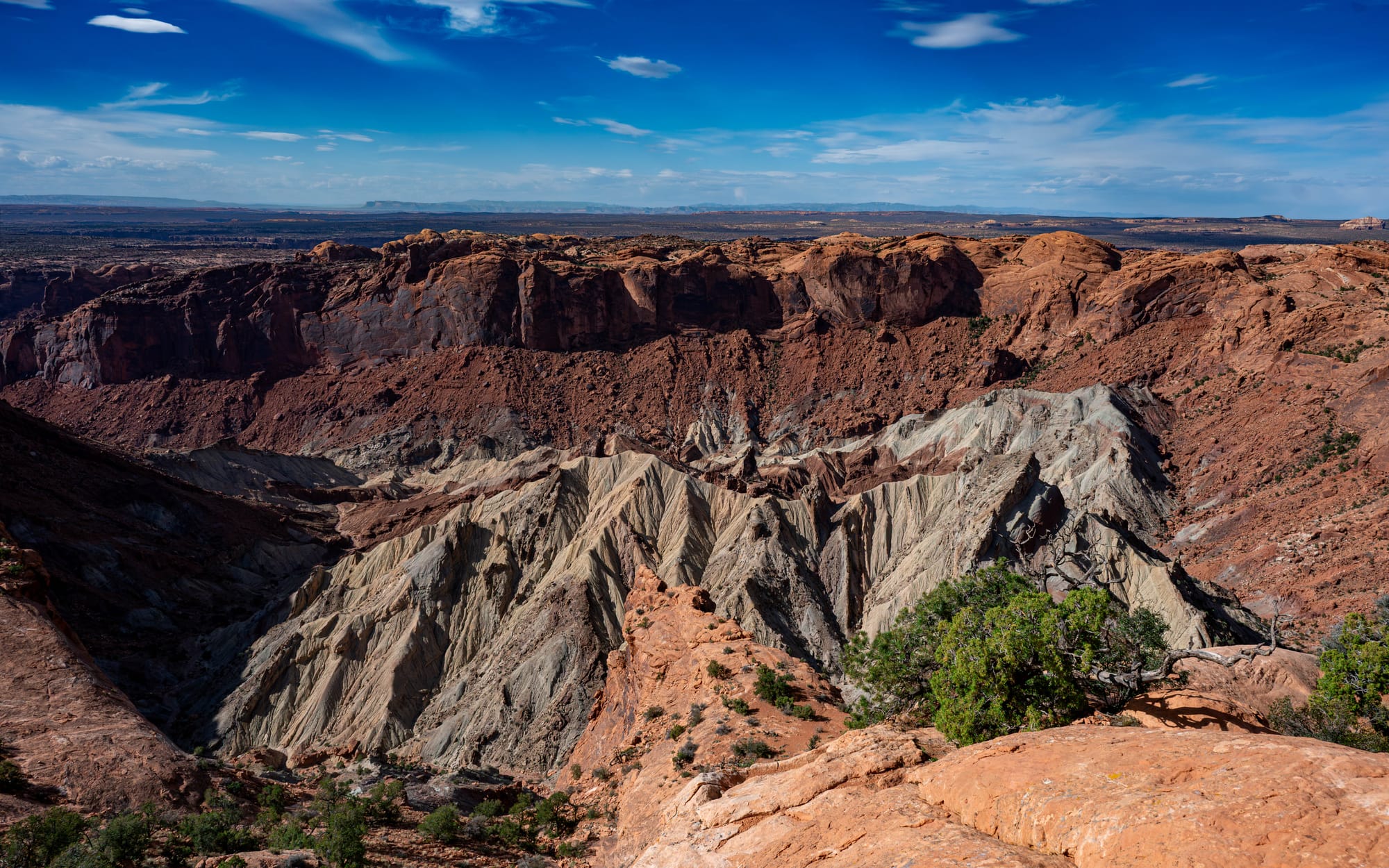
Upheaval Dome Breaks the Pattern
Most of Island in the Sky is a lesson in horizontal layers, canyon edges, and erosion. Upheaval Dome interrupts the whole system. The rock is folded, broken, and arranged in a circular structure that's completely different from the surrounding overlooks.
Its origin is still debated.
The two main theories are not minor variations of the same idea. Either a salt dome pushed the rock upward from below, or a meteor impact disrupted the layers from above. Geologists still do not know for sure and the two theories are hotly debated. Though recent research supports the meteorite hypothesis, many questions remain.
After a day of reading the landscape through strata, erosion, rims, and canyons, Upheaval Dome is a hard left turn. It does not fit neatly into the rest of the park. It is a reminder that even in a landscape that starts to feel readable, there are still odd chapters.
⚡ TL;DR
- Park highlight: Island in the Sky’s layered canyon views from Grand View Point
- Best for: Large overlooks, photography, geology, scenic drives, and big buttes
- Skip if: You don't like rocks
- Worth planning around?: Yes
Final Takeaways
Canyonlands felt unfinished in the right way.
Island in the Sky gave us the easiest access, but not a complete picture. It was an introduction.
Mesa Arch is still on the list, ideally at sunrise. Shafer Trail and the White Rim Road feel like future trips of their own. The Needles deserves its own visit, and The Maze is hard not to wonder about once you realize how little of Canyonlands you have actually touched.
A first visit does not make the park feel smaller.
It makes the map bigger.
Some parks show you their main feature immediately. Canyonlands makes you keep looking.