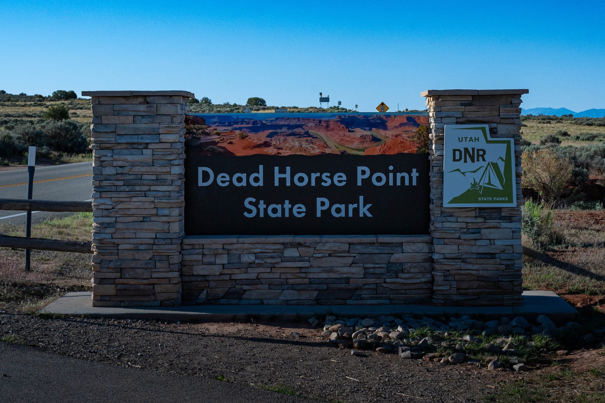
Dead Horse Point State Park
We drove to Dead Horse Point State Park from North Moab early to beat the heat.
The drive felt familiar because you are basically heading toward Canyonlands. From Moab, you head north on US 191, then turn onto UT-313, the same road that leads toward the Island in the Sky district. Dead Horse Point sits off that approach, high above the Colorado River and the surrounding canyon country.
If you want to camp near Canyonlands but stay in a state park, Dead Horse Point is the place to go. It has developed camping, rim access, and a quieter feel than staying closer to Moab. There are also scattered BLM campsites in the broader area, but once you are out that way, there is not much civilization.
That is not necessarily a bad thing.
The park feels like it belongs on the edge. Moab is close enough to make the day easy, but far enough away that Dead Horse Point feels exposed, open, and separate from town.
🗺️ The Lay of the Land
- Location: Moab, Utah · 38.5083, -109.7423 · [Google Maps]
- Official site: [Dead Horse Point State Park]
- Landscape: canyon rim · high desert
- Vibe: exposed mesa, huge views, and quiet rim walking
- Our stay & conditions: May 10, 2026 · day visit · clear skies, cool morning, warm afternoon
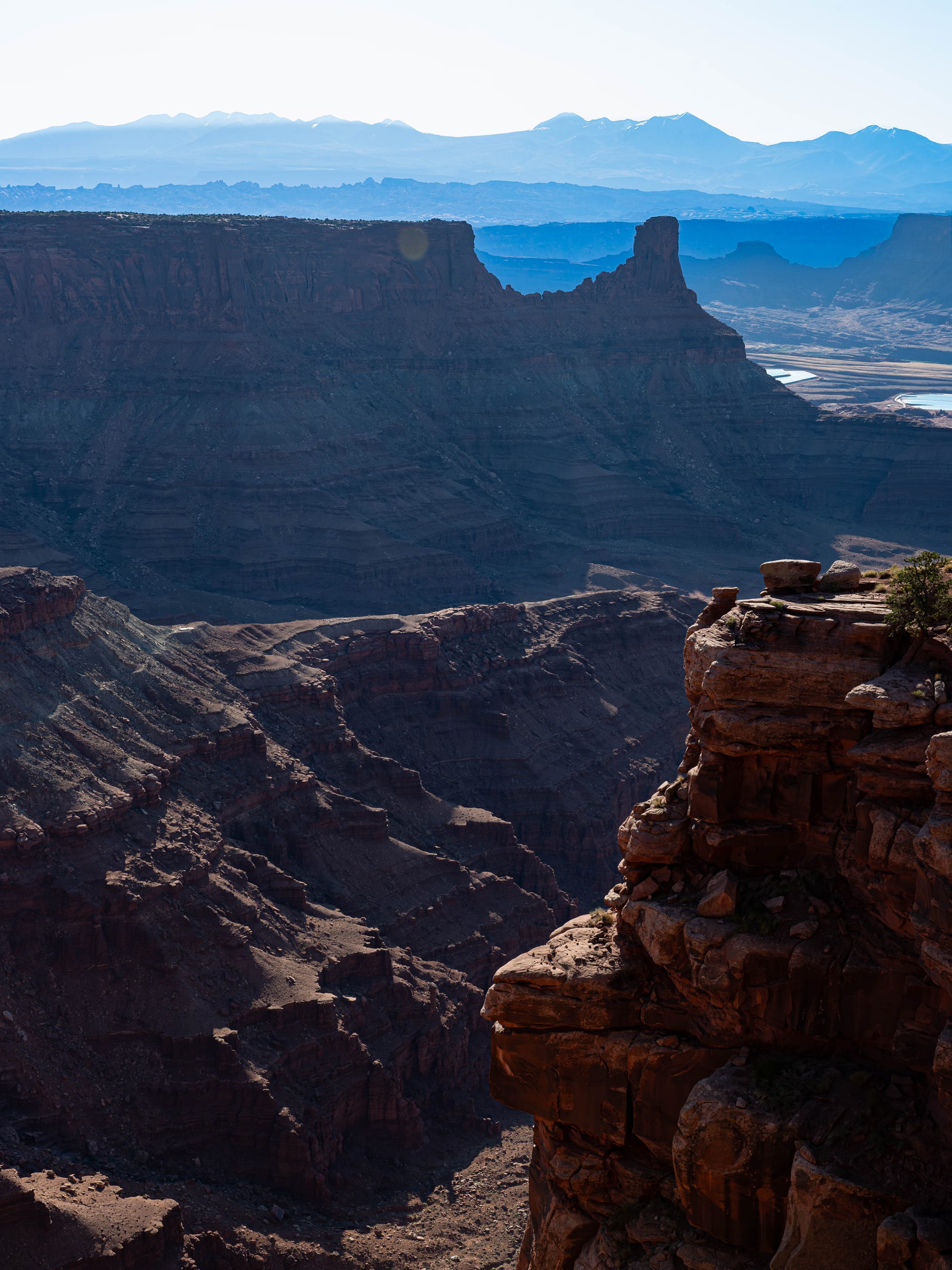
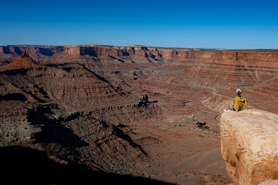
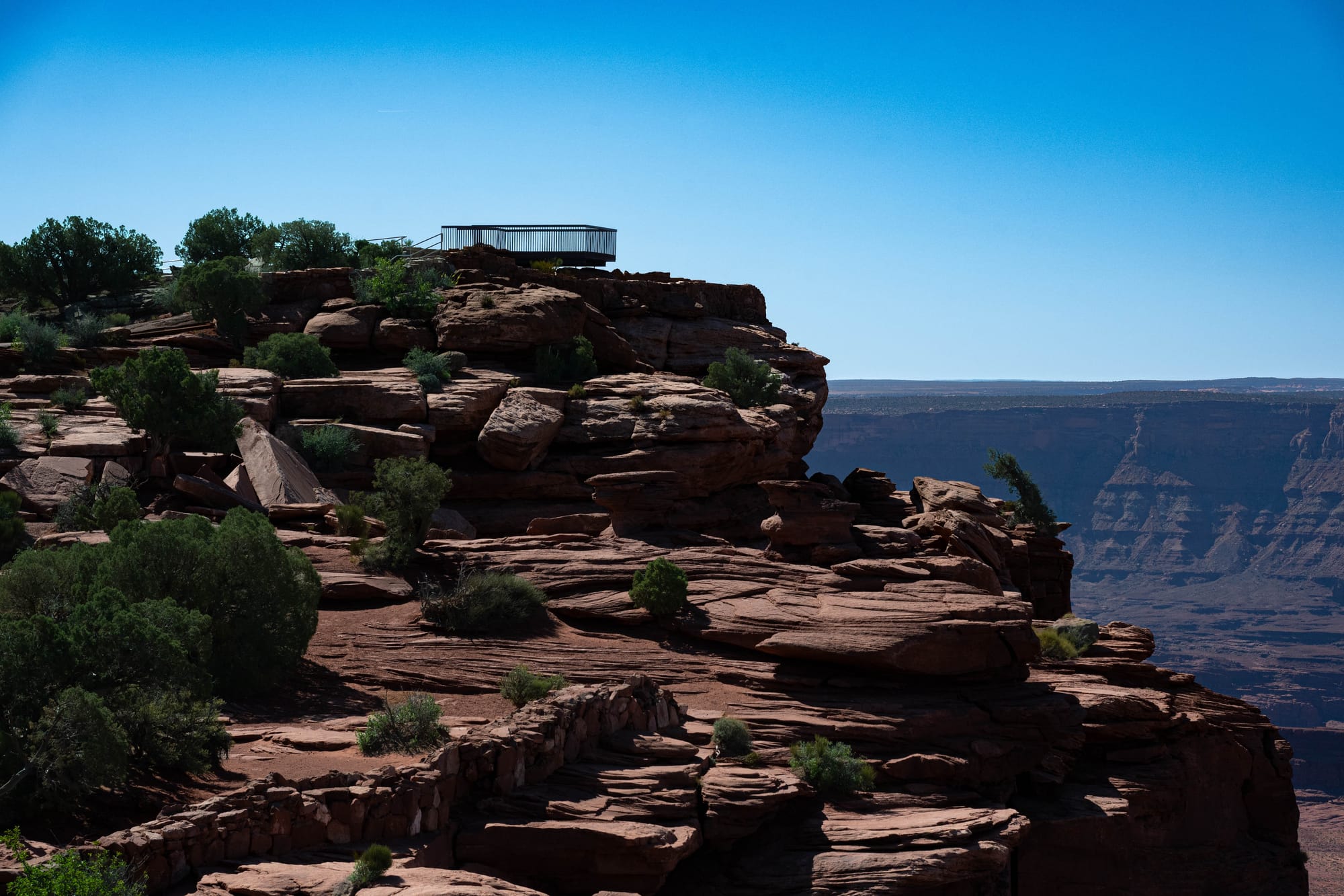
We hiked the East Rim and West Rim loop with the pups.
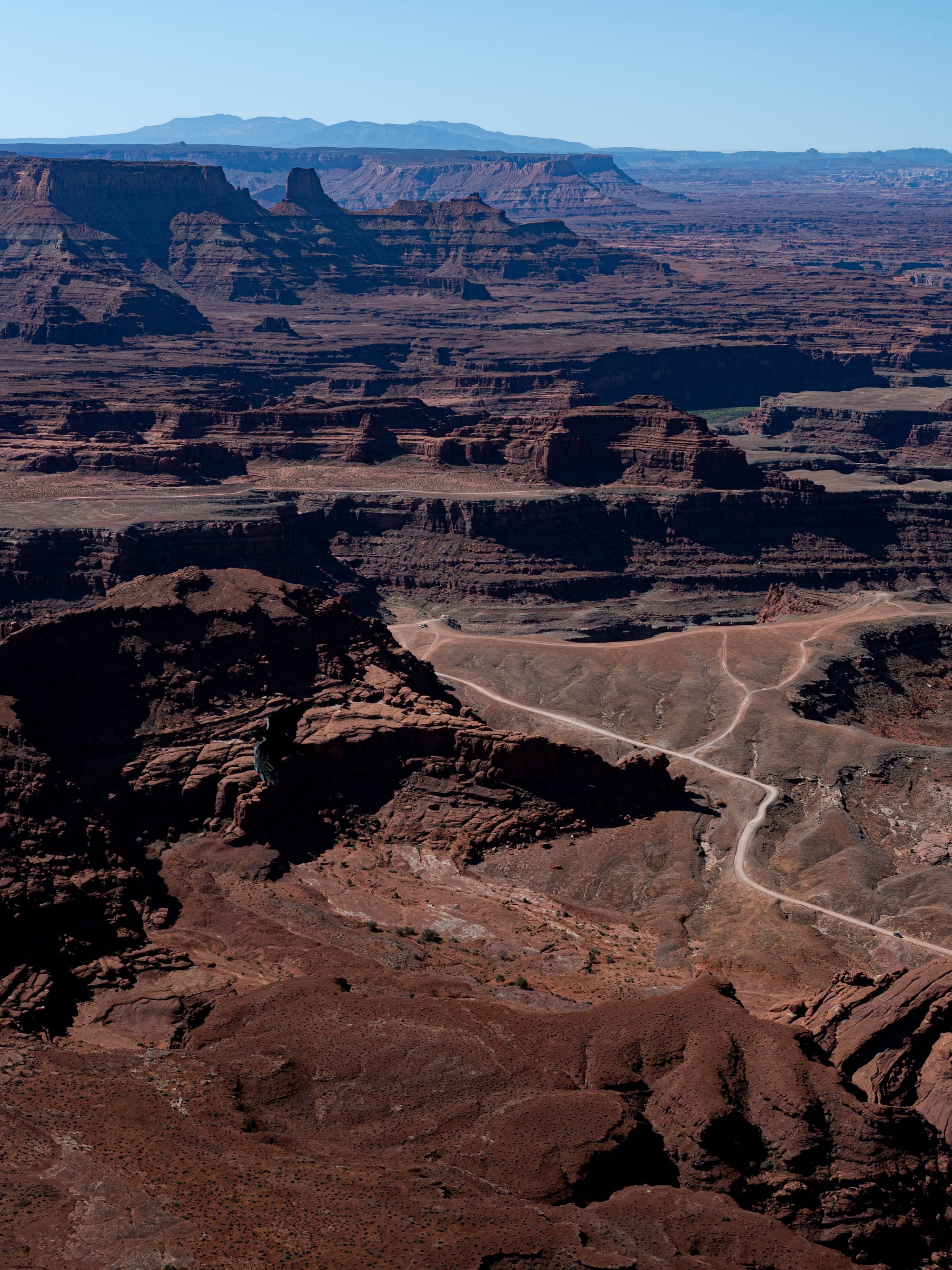
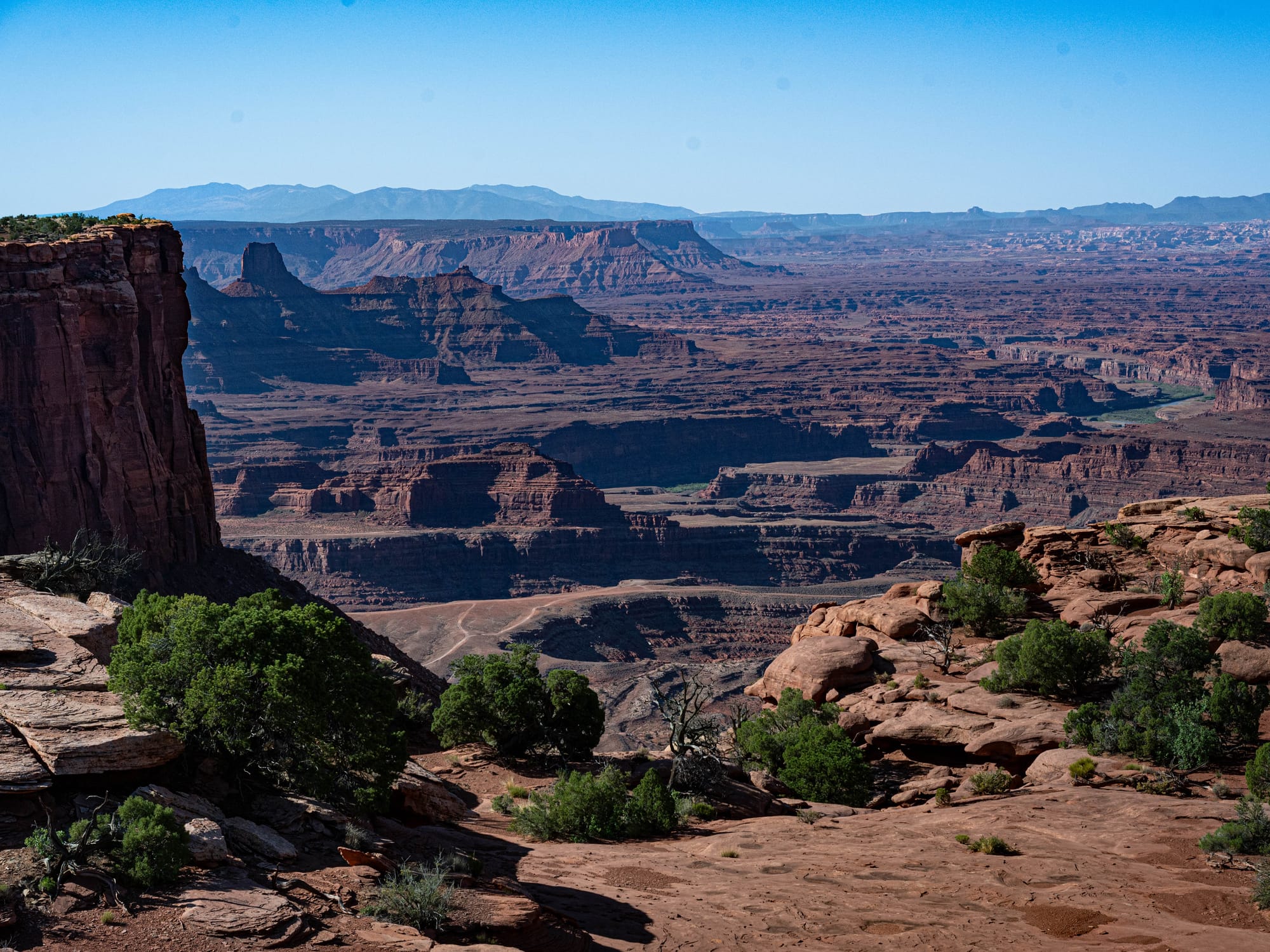
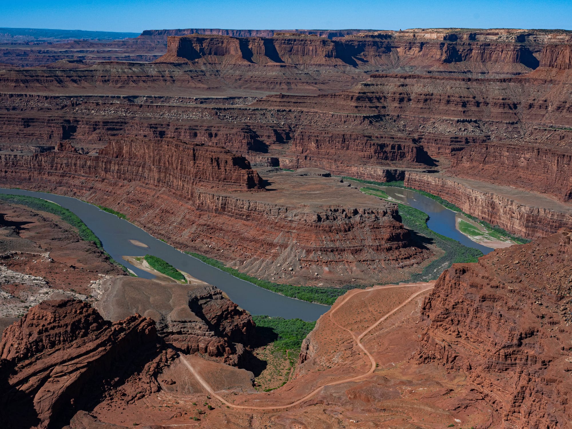
It was a good way to see the park because the trail keeps bringing you back to the canyon edge from different angles. You are not hiking down into the canyon. You are walking the rim, looking across and down into a landscape that is hard to measure.
The cliffs fall more than a thousand feet, and from the rim, everything below gets compressed. Giant boulders look small. Old roads turn into faint lines. At one point, we could see a Jeep moving through the lower canyon, and even that looked tiny against the rock.
The canyon is hard to describe because its size does not translate cleanly. You can understand the number. You can read the elevation change. But standing on the rim is different. The space keeps opening beyond whatever your eyes first settle on.
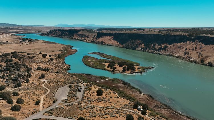
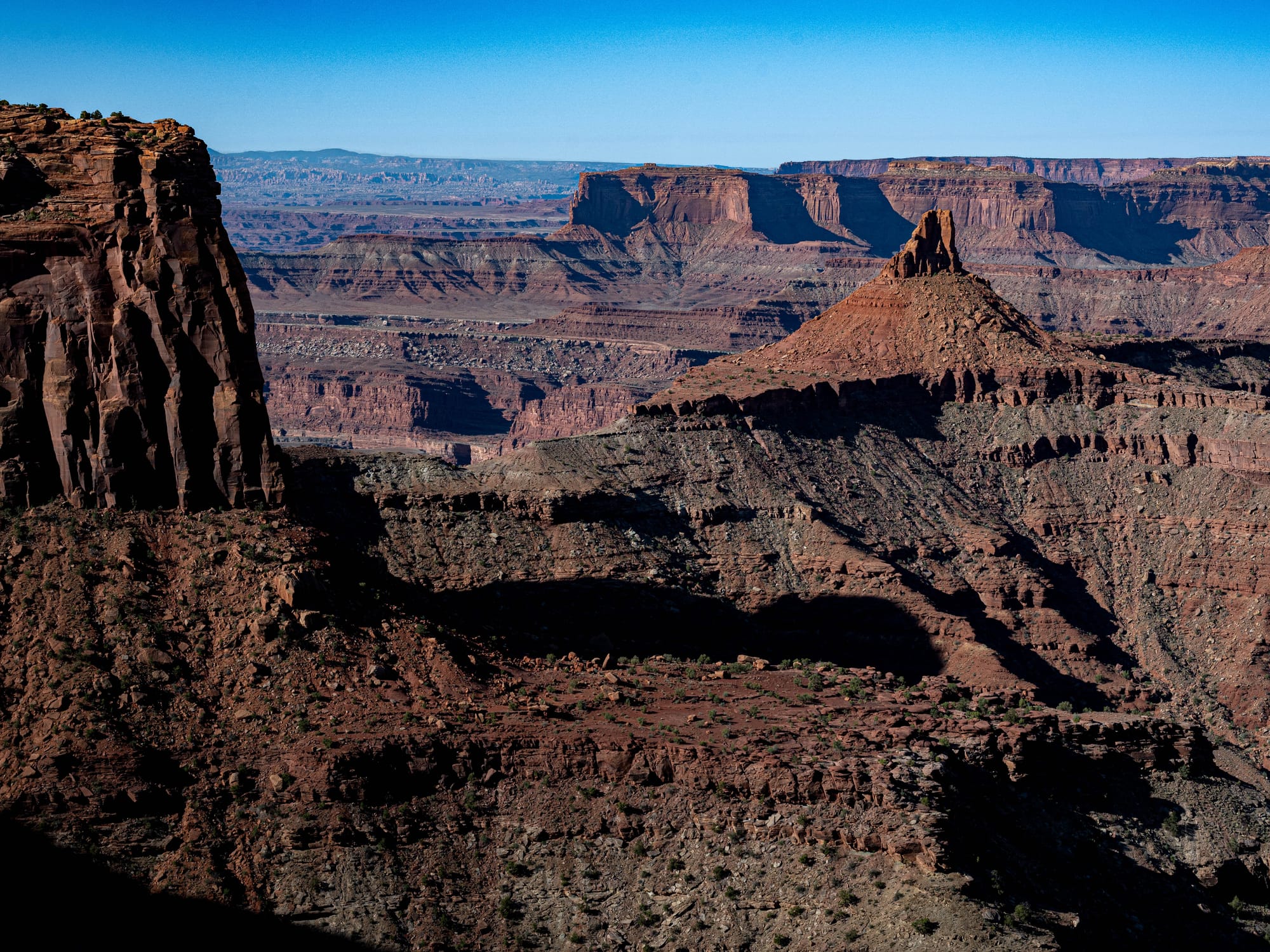
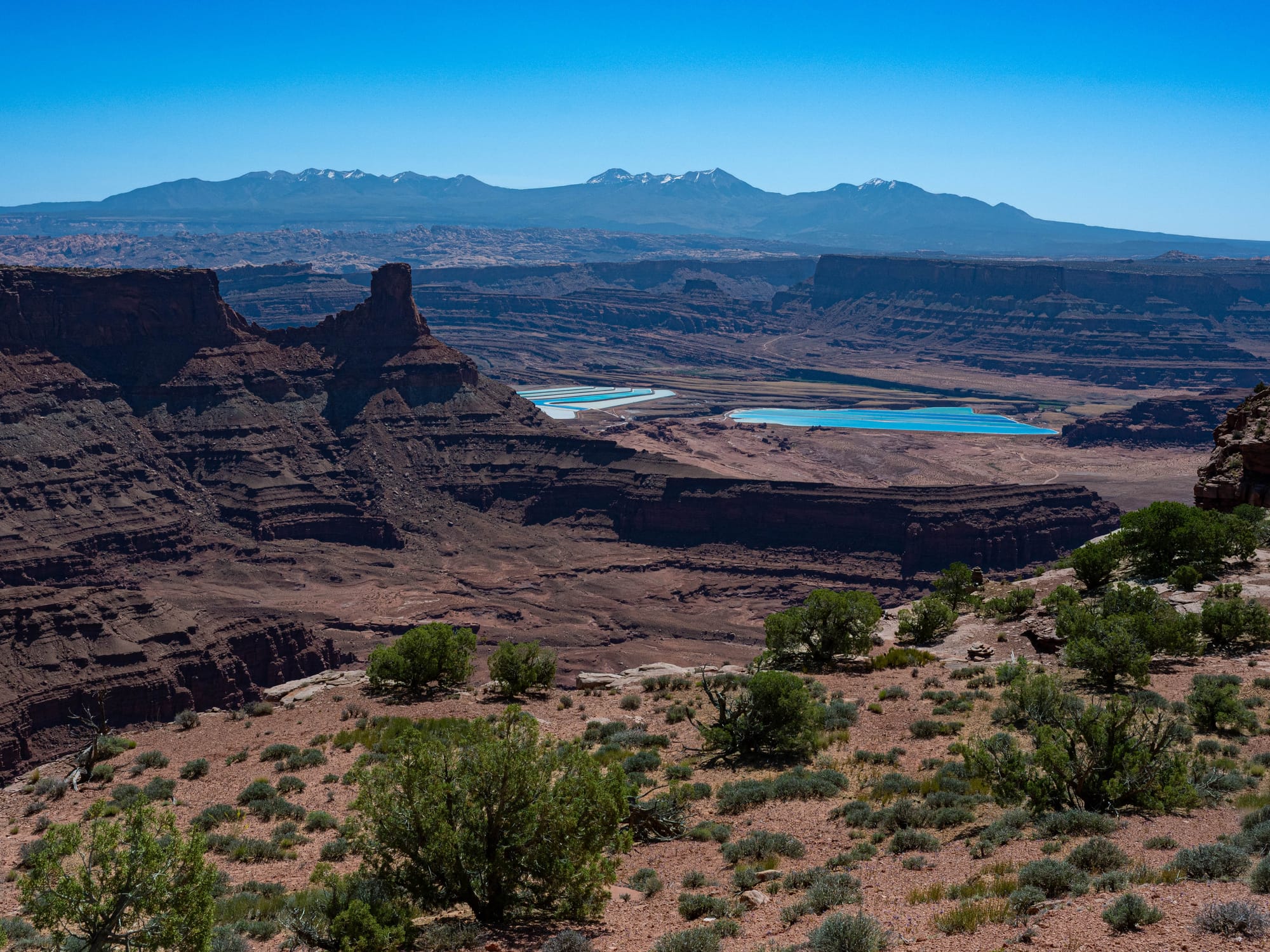
What surprised me was how much green we could see near the river.
After visiting Arches and Canyonlands first, you start to understand how scarce water is in this part of Utah. Away from the Colorado and Green Rivers, the landscape gets dry fast. From Dead Horse Point, that contrast is visible. The river corridor holds more life. The rest of the canyon country depends on what little water can be caught, shaded, stored, or survived.
You are not just looking at a canyon. You are looking at the difference between water and no water.
🚴 On the Ground
- Activities available: ● 🥾 Hiking | ● 🚴 Biking | ● 🐕 Dogs | ○ 🚣 Paddling | ○ 🎣 Fishing | ● 🐦 Wildlife / Birding | ○ 🏊 Swimming | ● 📸 Photography | ● 🏕️ Camp-centric | ○ 🧗 Climbing
- Trail mileage available: 🥾 8 mi | 🚴 17 mi | 🚣 ⟂
- Crowd level: Moderate
Legend: ● = available · ○ = not available
Park Highlights
Dead Horse Point became a Utah state park in 1959. The name comes from the old story that cowboys used the point as a natural corral, fencing off the narrow neck of land and letting the cliffs form the rest of the enclosure. The exact details are hard to verify, but the geography makes the story easy to picture. From the rim, there is one obvious way in and out, and everything else falls away.
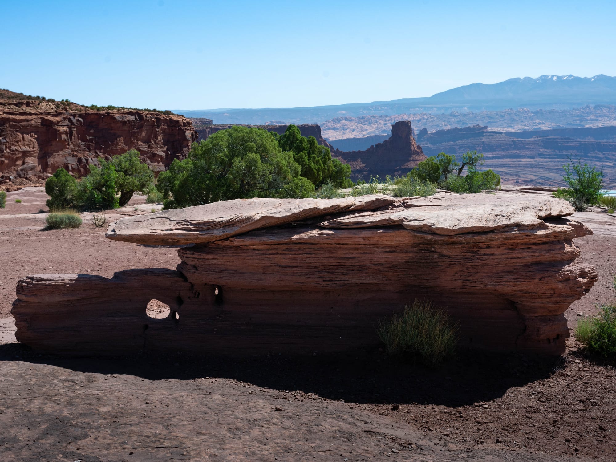
The rock story is just as visible.
Dead Horse Point sits on the Colorado Plateau, where old sedimentary layers were stacked, buried, hardened, lifted, and cut open over time. Around the Moab area, those layers include sandstones, mudstones, and siltstones.
The layers are old enough to make the view feel even stranger. Kayenta Formation is roughly 184 to 188 million years old, with older Cutler Group rocks lower in the canyon dating roughly 270 to 285 million years ago.
And those layers do not erode the same way.
Harder sandstones form cliffs, ledges, and rims. Softer mudstones and siltstones weather into slopes and benches. Over time, the Colorado River and its side drainages cut down through the stack, exposing the layers and leaving behind the canyon texture you see from the rim.
That helps explain the scale of the place. The drop is not one clean wall. It is steps, shelves, slopes, cliffs, cracks, and ledges. The canyon looks permanent, but it is being shaped by water, wind, heat, cold, and gravity every day.

⚡ TL;DR
- Park highlight: East Rim and West Rim loop around the canyon
- Best for: Big canyon views, photography, rim hiking, and a half-day trip from Moab
- Skip if: You want shade, water access, or a long backcountry-style hike
- Worth planning around?: Yes
Final Takeaways
Dead Horse Point worked well as a half-day visit from Moab.
The East Rim and West Rim loop gave us more than an overlook stop without turning the day into a major undertaking. It was exposed, dry, and wide open, but the trail kept returning us to new angles on the same massive canyon system.
For us, the park helped connect pieces we had been seeing all week: the cliffs, the river, the dry mesa tops, the thin green line of water, and the scale of canyon country.
Dead Horse Point does not need much explanation once you are standing there.
The rim does most of the work.
We'll be back more more than a day next time.